Yoho National Park Hiking
The most popular hiking destination in Yoho National Park is Lake O’Hara (see Lake O’Hara Hiking), but visiting this very special place requires advance planning. We also recommend the following Yoho trails.
The best source of Yoho National Park hiking information is the Canadian Rockies Trail Guide by Brian Patton and Bart Robinson, which details all trails and has accompanying colour photos and maps.
Emerald Lake Hikes
Emerald Lake Loop Trail
Length: 5.2 kilometres/3.2 miles (1.5 hours) round-trip
Elevation gain: minimal
Rating: easy
Trailhead: Emerald Lake parking lot, 9 kilometres (5.6 miles) from Highway 1
One of the easiest yet most enjoyable walks in Yoho is around the park’s most famous lake. The trail encircles the lake and can be hiked in either direction. The best views are from the western shoreline, where a massive avalanche has cleared away the forest of Engelmann spruce. Across the lake from this point, Mount Burgess can be seen rising an impressive 2,599 metres (8,530 feet). Traveling in a clockwise direction, beyond the avalanche slope, the trail to Emerald Basin veers off to the left, and at the 2.2-kilometre (1.4-mile) mark, a small bridge is crossed. Views from this point extend back across the lodge to the Ottertail Range. Beyond the lake’s inlet, the vegetation changes dramatically. A lush forest of towering western red cedar creates a canopy, protecting moss-covered fallen trees, thimbleberry, and bunchberry extending to the water’s edge. Just over one kilometre (0.6 mile) from the bridge, the trail divides: The left fork leads back to the parking lot via a small forest-encircled pond, or continue straight ahead through the grounds of Emerald Lake Lodge. Park staff lead a guided hike around the lake every Saturday morning, departing at 10 a.m. from the parking lot trailhead.
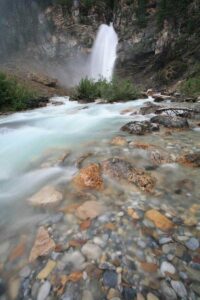
Hamilton Falls Trail
Length: 800 metres/0.5 mile (40 minutes) one-way
Elevation gain: 60 metres/200 feet
Rating: easy
Trailhead: information kiosk, Emerald Lake parking lot
The trail to these falls begins from the Emerald Lake parking lot, down the hill from the bridge to the lodge. It’s an easy walk through a forest of Engelmann spruce and subalpine fir to a viewpoint at the base of the falls. A little farther along, the trail begins switchbacking steeply and offers even better views of the cascade. The trail continues beyond the waterfall to Hamilton Lake, which lies in a small glacial cirque a steep 880 vertical metres (2,890 feet) above Emerald Lake. Total distance from Emerald Lake to Hamilton Lake is 5.5 kilometres/3.4 miles (2.5 hours) one-way.
Emerald Basin Trail
Length: 4.5 kilometres/2.8 miles (1.5 to 2 hours) one-way
Elevation gain: 280 metres/920 feet
Rating: easy/moderate
Trailhead: information kiosk, Emerald Lake parking lot
The trail to the delightful Emerald Basin begins from the west shore of Emerald Lake, from where it’s a steady three-kilometre (1.9-mile) climb through a subalpine forest to the basin, which, chances are, you’ll have to yourself. The most impressive sight awaiting you there is the south wall of the President Range, towering 800 vertical metres (2,625 feet) above.
Yoho Valley Hikes
The valley for which the park is named lies north of the Trans-Canada Highway. As well as the sights discussed previously, it provides many fine opportunities for serious day hikers to get off the beaten track. The following day hikes begin from different trailheads near the end of the road up Yoho Valley. In each case, leave your vehicle in the Takakkaw Falls parking lot.
Twin Falls Trail
Length: 8 kilometres/5 miles (2.5 hours) one-way
Elevation gain: 300 metres/980 feet
Rating: moderate
Trailhead: Takakkaw Falls parking lot, 14 kilometres (8.7 miles) from Highway 1
Laughing Falls
This trail takes over where the road through the Yoho Valley ends, continuing in a northerly direction up the Yoho River to Twin Falls, passing many other waterfalls along the way, including Laughing Falls. At spectacular Twin Falls, water from the Wapta Icefield divides in two before plunging off an 80-metre-high (262-foot-high) cliff. Mother Nature may work in amazing ways, but sometimes she needs a helping hand–or so the CPR thought. In the 1920s, the company dynamited one of the channels to make the falls more symmetrical. Twin Falls Chalet was built below the falls by the CPR in 1923 and today offers hikers light snacks through the middle of the day.
Iceline Trail
Length: 6.4 kilometres/4 miles (2.5 hours) one-way
Elevation gain: 690 metres/2,260 feet
Rating: moderate/difficult
Trailhead: HI—Yoho (Whiskey Jack Hostel)
The Iceline is one of the most spectacular day hikes in the Canadian Rockies. The length given is from HI—Yoho to the highest point along the trail (2,250 metres/7,380 feet). (Day hikers are asked to leave their vehicles across the road from the hostel, in the Takakkaw Falls parking lot.) From the hostel, the trail begins a steep and steady one-kilometre (0.6-mile) climb to a point where two options present themselves: The Iceline Trail is to the right, and Yoho Lake is to the left. After another 20 minutes of walking, the Iceline Trail option enters its highlight–a four-kilometre (2.5-mile) traverse of a moraine below Emerald Glacier. Views across the valley improve as the trail climbs to its crest and passes a string of small lakes filled with glacial meltwater. Many day hikers return from this point, although officially the trail continues into Little Yoho River Valley. Another option is to continue beyond Celeste Lake and loop back to Takakkaw Falls and the original trailhead, a total distance of 18 kilometres (11.2 miles).
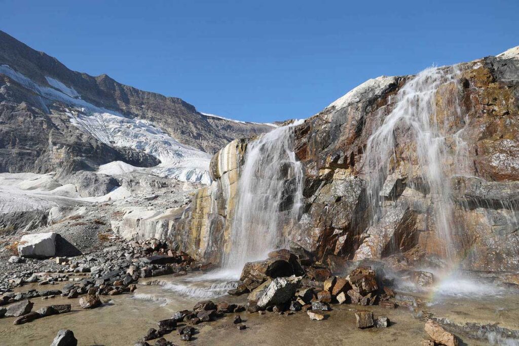
Along the Iceline Trail.
Yoho Lake Trail
Length: 3.7 kilometres/2.3 miles (1.5 hours) one-way
Elevation gain: 300 metres/990 feet
Rating: moderate
Trailhead: HI—Yoho (Whiskey Jack Hostel)
The trail to Yoho Lake, which can be combined with the Iceline Trail, officially begins along the hostel access road, but hikers are asked to leave their vehicles across the road in the Takakkaw Falls parking lot. It leads 3.7 kilometres (2.3 miles) to picturesque, spruce-encircled Yoho Lake, where you find picnic tables and campsites. Options from this point include continuing to Yoho Pass (below the tree line), from where it’s 5.5 kilometres (3.4 miles) and an elevation loss of 530 metres (1,740 feet) down to Emerald Lake; six kilometres (3.7 miles) and an elevation gain of 300 metres (985 feet) to spectacular Burgess Pass; or 2.4 kilometres (1.5 miles) north, with moderately steady elevation, to an intersection with the Iceline Trail.
Hikes in Other Areas of the Park
The hikes detailed as follows are along the Trans-Canada Highway.
Sherbrooke Lake Trail
Length: 3.1 kilometres/1.9 miles (1 hour) one-way
Elevation gain: 180 metres/560 feet
Rating: easy/moderate
Trailhead: Wapta Lake day use area (not signposted), 5 kilometres (3.1 miles) west of the Continental Divide
The hike to Sherbrooke Lake, which is fed by the Waputik Icefield, is easier than trails to most other subalpine lakes as the trailhead is close to where the Trans-Canada Highway crosses the Continental Divide, meaning less elevation gain is needed. Most of the elevation is gained in the first half of the hike, after which the trail levels out and before you know it, you’ll arrive at the rocky lakeshore. A rough trail continues beyond the lake to NILES MEADOWS (allow another two hours each way), although a more popular option is the trail to PAGET LOOKOUT, which is moderately strenuous but worthwhile for the panorama of the Kicking Horse River Valley. This option is signposted near the halfway mark of the trail to Sherbrooke Lake. The first section traverses a forest of Engelmann spruce. Then the trail breaks out above the tree line just below the lookout, the site of an abandoned fire tower, 3.5 kilometres (2.2 miles) from the highway trailhead and with an elevation gain of 520 metres (1,700 feet).
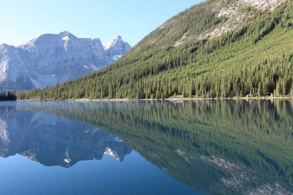
Looking down the Yoho Valley from Paget Peak
Hoodoo Trail
Length: 3 kilometres/1.9 miles (60 to 90 minutes) one-way
Elevation gain: 460 metres/1,510 feet
Rating: moderate
Trailhead: Hoodoo Creek Campground, 23 kilometres (14.3 miles) southwest of Field
Hoodoos are found in varying forms throughout the Canadian Rockies, but this outcrop, officially known as the Leanchoil Hoodoos, is among the most impressive. Hoodoos are formed by the erosion of relatively soft rock from beneath a cap of harder, more weather-resistant rock. Although these examples require some effort to reach, their intriguing appearance makes the trip worthwhile. The first half of the trail, through a decommissioned campground, is relatively flat, leaving all the elevation gain to be made in the last, painful 1.5 kilometres (0.9 mile).
Wapta Falls Trail
Length: 2.4 kilometres/1.5 miles (45 minutes) one-way
Elevation loss: minimal
Rating: easy
Trailhead: 1.8 km (1.1 miles) along an unmarked road 25 kilometres (15.5 miles) west of Field and 5 kilometres (3.1 miles) east of park boundary
In the park’s extreme southwestern corner, this trail follows an old fire road for one kilometre (0.6 miles), then narrows for an easy stroll through thick forest to a viewpoint above these 30-metre-high (100-feet-high) falls on the Kicking Horse River. A steep, switchbacking descent leads 500 metres (0.3 mile) to a viewpoint downstream of the base of the falls.