Canadian Rockies Maps
The best Canadian Rockies maps are produced by GEM TREK MAPS. Renowned for their accuracy and detail, Gem Trek Maps are printed on waterproof and tear-resistant paper.
For details on maps for specific regions, click through the links below:
Banff National Park
Jasper National Park
Yoho National Park
Kootenay National Park
Canmore
Kananaskis Country
Waterton Lakes National Park
We also provide details for maps to these specific destinations:
Lake Louise
Mount Assiniboine
Lake O’Hara
Icefields Parkway
Gem Trek Maps
Detail of a Gem Trek Map.
Gem Trek is a Banff-based business that has been publishing high-quality Canadian Rockies maps for over 30 years. Each regularly updated Gem Trek Map features distinctive relief shading and clearly marked hiking trails, points of interest, and mountain ranges.
Gem Trek Maps feature:
- waterproof and tear-resistant paper
- contour lines at 50-metre (165-foot) intervals
- relief shading to better show the topography
- full colour on both sides
- hiking trails, with trail names and trail distances marked
- detailed descriptions of 29 hiking trails on reverse side of map
- hydrology—rivers, rapids, glaciers, and waterfalls
- mountain names and all available mountain elevations
- all campgrounds
- points of interest and attractions
- day use areas
- highway viewpoints
Maps can be purchased directly through the Gem Trek Maps website with minimal shipping charges. They are also sold at visitor centres, outdoor retailers, and lodges throughout the Canadian Rockies. In Calgary, MAP TOWN (400 5th Ave. SW, 403/266-2241) is a specialist map shop worth stopping at as you pass through.
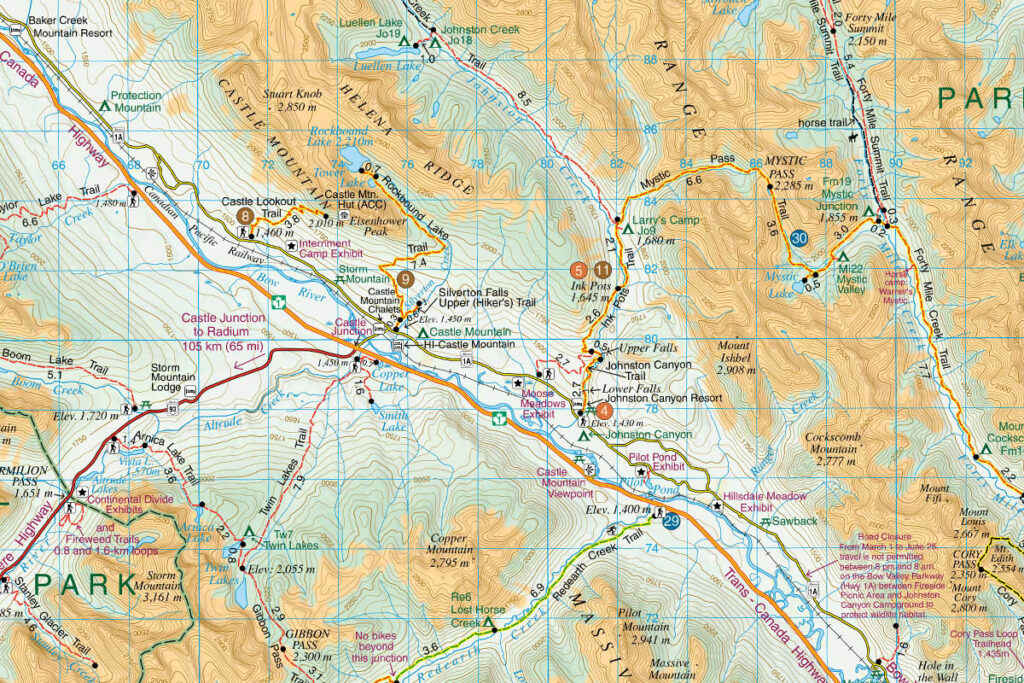
Detail of a Gem Trek Map.
Government Topographical Maps
Like the rest of Canada, the Canadian Rockies are covered by the NATIONAL TOPOGRAPHIC SYSTEM (NTS) 1:50,000 scale maps. They show hiking trails, although not always with a high degree of accuracy. Elevations are metric on most sheets, usually with a contour interval of 40 m (occasionally 20 m at lower elevations). Unfortunately, it takes over 40 of these maps to cover the region, and even shorter trails can sometimes run over two or three sheets. The government does produce single sheet 1:50,000 scale maps covering Waterton Lakes National Park and Yoho National Park. These maps provide the same topographical detail available on NTS maps and better detail for trails and campgrounds.