Jasper National Park Hiking
The 1,200 kilometres (745 miles) of hiking trails in Jasper National Park are significantly different from those in the other mountain parks. Jasper National Park has an extensive system of interconnecting backcountry trails that, for experienced hikers, can provide a wilderness adventure rivalled by a few areas on the face of the earth. For casual day hikers, on the other hand, opportunities are more limited.
Most trails in the immediate vicinity of the town have little elevation gain and lead through montane forests to lakes. The trails around Maligne Lake, at the base of Mount Edith Cavell, along the Icefields Parkway, and at the Columbia Icefield (see Columbia Icefield Hiking) have more rewarding objectives and are more challenging.
 Before setting off on any hikes, whatever the length, go to the Jasper Visitor Centre in downtown Jasper or the Parks Canada desk in the Icefield Centre along the Icefields Parkway for trail maps, trail conditions, and trail closures, or to purchase a copy of the Canadian Rockies Trail Guide, by Brian Patton and Bart Robinson. This hiking book is also available directly from Summerthought Publishing by following this link: Canadian Rockies Trail Guide.
Hiking around the Town of Jasper
Pyramid Benchland Trail
Length: 7 kilometres/4.3 miles (2 hours) round-trip
Elevation gain: 120 metres/400 feet
Rating: easy
Trailhead: Jasper-Yellowhead Museum, Pyramid Lake Road
Numerous official and unofficial hiking trails weave across the benchland immediately west of the town of Jasper. From the far corner of the parking lot beside the museum, a well-marked trail climbs onto the benchland. Keep right, crossing Pyramid Lake Road, and you’ll emerge on a bluff overlooking the Athabasca River Valley. Bighorn sheep can often be seen grazing here. If you return to the trailhead from here, you will have hiked seven kilometres (4.3 miles). The trail continues north, disappearing into the montane forest until arriving at Pyramid Lake. Various trails can be taken to return to town; get a map at the Jasper Visitor Centre before setting out.
Mina Lakes Trail
Length: 2.5 kilometres/1.5 miles (50 minutes) one-way
Elevation gain: 70 metres/230 feet
Rating: easy
Trailhead: Jasper-Yellowhead Museum, Pyramid Lake Road
Lower and Upper Mina Lakes lie on the benchland immediately west of the town of Jasper. The trailhead is the same as the Pyramid Lake Loop, except instead of keeping right, you’ll need to take the first left fork (signposted as Route 8 to Cabin Creek West), which climbs up onto the bench, then crosses a treeless 100-metre-wide (328-foot-wide) corridor, cleared to act as a firebreak for the town. Cabin Lake Road passes along the firebreak, leading west (left) to man-made Cabin Lake and east (right) to Pyramid Lake Road. Continuing straight ahead, the trail climbs gradually through a typical montane forest of lodgepole pine, Douglas fir, and poplar before emerging at Lower Mina Lake. After a further 500 metres (0.3 mile) and just beyond the end of Lower Mina Lake, the upper lake and a pebbly stretch of beach are reached. The distance given above is to this point, but with a map in hand, it’s possible to continue along the shore of the upper lake; two kilometres (1.2 miles) beyond the end of the lake the trail forks—looping back along Cabin Lake Road via Cabin Lake to the left and to Riley Lake to the right.
Patricia Lake Trail
Length: 5-kilometre/3.1-mile loop (90 minutes round-trip)
Elevation gain: minimal
Rating: easy
Trailhead: 2 kilometres (1.2 miles) along Pyramid Lake Road
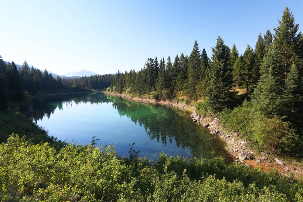
This trail begins across the road from the riding stables on Pyramid Lake Road. It traverses a mixed forest of aspen and lodgepole pine—prime habitat for larger mammals such as elk, deer, and moose. The second half of the trail skirts Cottonwood Slough, where you’ll see several beaver ponds. Unlike the name suggests, this trail doesn’t encircle Patricia Lake, but instead just passes along a portion of its southern shoreline.
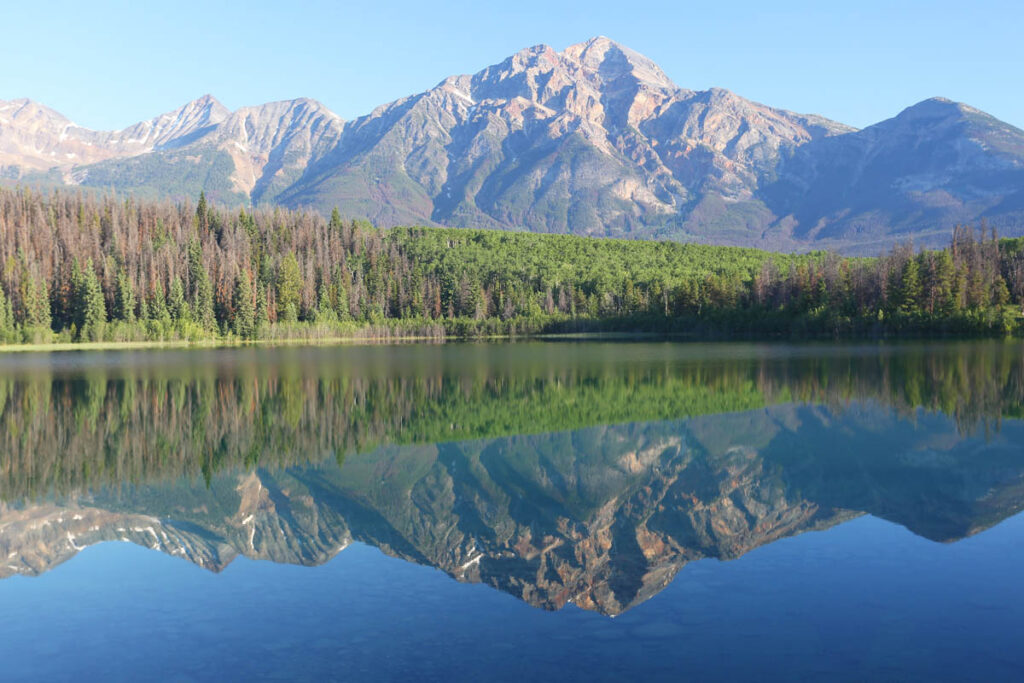
Patricia Lake.
The Palisade Trail
Length: 11 kilometres/6.8 miles (4 hours) one-way
Elevation gain: 850 metres/2,790 feet
Rating: difficult
Trailhead: the end of Pyramid Lake Road, 8 kilometres (5 miles) from town
The destination of this strenuous hike is the site of an old fire lookout tower atop a high ridge between the Athabasca River Valley and Pyramid Mountain. From the locked gate at the end of Pyramid Lake Road, the trail crosses Pyramid Creek after one kilometre (0.6 mile), then climbs steadily for the entire distance along a forest-enclosed fire road (take the right fork at the 7.5-km/4.7-mile mark). Once at the end of the trail, it’s easy to see why this site was chosen for the lookout; the panorama extends down the valley and across Jasper Lake to Roche Miette (2,316 metres/7,600 feet).
Old Fort Point Trail
Length: 6.5-kilometre/4-mile loop (2 hours round-trip)
Elevation gain: 60 metres/200 feet
Rating: easy
Trailhead: Take Highway 93A south from downtown, follow the first left after crossing Highway 16, and park across the Athabasca River.
Old Fort Point is a distinctive knoll above the Athabasca River, to the east of town. Although it is not likely that a fort was ever located here, the first fur-trading post in the Rockies, Henry House, was just downstream. It’s easy to imagine fur traders and early explorers climbing to this summit for 360-degree views of the Athabasca and Miette Rivers. From the parking lot beyond the single-lane vehicle bridge over the Athabasca River, climb the wooden stairs, take the trail to the top of the knoll, and then continue back to the parking lot along the north flank of the hill.
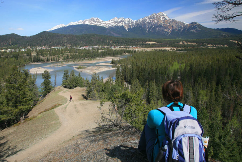
Old Fort Point.
The Whistlers Trail
Length: 8 kilometres/5 miles (3 hours) one-way
Elevation gain: 1,220 metres/4,000 feet
Rating: difficult
Trailhead: 3 kilometres (1.9 miles) along Whistlers Road from Highway 93
This steep ascent, Jasper National Park’s most arduous day hike, is unique in that it passes through three distinct vegetation zones in a relatively short distance. (For the less adventurous, Jasper Tramway (780/852-3093) traverses the same route described here.) From the trailhead on Whistlers Road, immediately below the hostel, the trail begins climbing and doesn’t let up until you merge with the crowds getting off the tramway at the top. The trail begins in a montane forest of aspen and white birch, climbs through a subalpine forest of Engelmann spruce and alpine fir, then emerges onto the open, treeless tundra, which is inhabited by pikas, hoary marmots, and a few hardy plants. Carry water with you, because none is available before the upper tramway terminal. If you’ve taken the tramway, free guided hikes are offered around the summit area.
Hiking in the Maligne Lake Area
Maligne Lake, 48 kilometres (30 miles) from the town of Jasper, provides more easy hiking with many opportunities to view the lake and explore its environs. To get there, take Highway 16 east for four kilometres (2.5 miles) from town and turn south on Maligne Lake Road. The first three hikes detailed are along the access road to the lake; the others leave from various parking lots at the northwest end of the lake.
For detailed descriptions of local trails, visit our Maligne Lake hiking page.
Hiking near Mount Edith Cavell
Cavell Road begins from Highway 93A, 13 kilometres (eight miles) south from the town of Jasper, and winds through a subalpine forest, ascending 300 metres (980 feet) in 14.5 kilometres (nine miles). Trailheads are located at the end of the road (Cavell Meadows Trail and a short interpretive trail) and across from the hostel two kilometres (1.2 miles) from the end (Astoria River/Tonquin Valley Trail). A third trailhead is on Marmot Basin Road where it crosses Portal Creek (Maccarib Pass Trail).
Cavell Meadows Trail
Length: 4 kilometres/2.5 miles (1.5 hours) one-way
Elevation gain: 380 metres/1,250 feet
Rating: moderate
Trailhead: parking lot at the end of Cavell Road, 27.5 kilometres (17 miles) south of town
This trail, beginning from the parking lot beneath Mount Edith Cavell, provides access to an alpine meadow and panoramic views of Angel Glacier. The trail begins by following the paved Path of the Glacier Trail, then branches left, climbing steadily along a rocky ridge and then through a subalpine forest of Engelmann spruce and then stunted subalpine fir to emerge facing the northeast face of Mount Edith Cavell and Angel Glacier. The view of the glacier from this point is nothing less than awesome, as the ice spills out of a cirque, clinging to a 300-metre-high (984-foot-high) cliff face. The trail continues to higher viewpoints and an alpine meadow that, by mid-July, is filled with wildflowers.
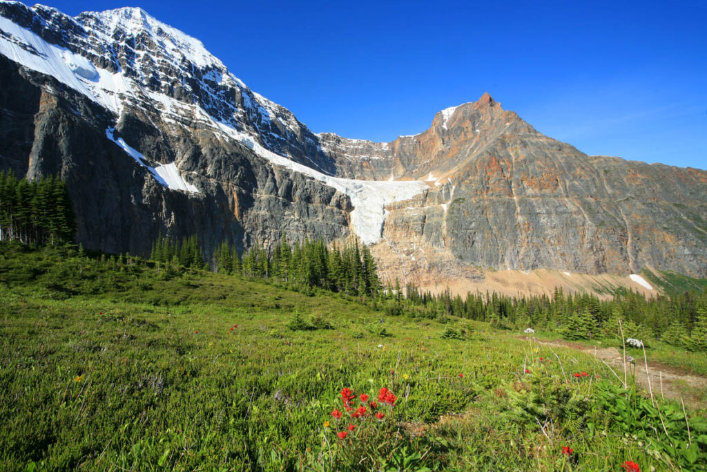
Angel Glacier from Cavell Meadows.
Astoria River/Tonquin Valley Trail
Length: 19 kilometres/11.8 miles (6 to 7 hours) one-way
Elevation gain: 450 metres/1,480 feet
Rating: overnight backpack
Trailhead: opposite the hostel on Cavell Road
From Cavell Road, this trail descends through a forest on the north side of Mount Edith Cavell for five kilometres (3.1 miles), then crosses the Astoria River and begins a long ascent into spectacular Tonquin Valley. Amethyst Lakes and the 1,000-metre (3,280-foot) cliffs of the Ramparts first come into view after 13 kilometres (eight miles). At the 17-kilometre (10.5-mile) mark the trail divides. To the left it climbs into Eremite Valley, where there is a campground. The right fork continues, following Astoria River to Tonquin Valley, Amethyst Lakes, and a choice of four campgrounds.
Maccarib Pass Hiking Trail
Length: 21 kilometres/13 miles (7 to 8 hours) one-way
Elevation gain: 730 metres/2,400 feet
Rating: overnight backpack
Trailhead: 6.5 kilometres (4 miles) up Marmot Basin Road
This trail is slightly longer and gains more elevation than the trail along Astoria River but is more spectacular. It strikes out to the southwest, following Portal Creek for a short distance, then passes under Peveril Peak before making a steep approach to Maccarib Pass, 12.5 kilometres (7.8 miles) from the trailhead. The full panorama of the Tonquin Valley can be appreciated as the path gradually descends from the pass. At Amethyst Lakes it links up with the Astoria River Trail, and many options for day hikes head out from campgrounds at the lakes.
Icefields Parkway Hiking Trails
For those who aren’t comfortable hiking in remote areas, many of the trails branching off the Icefields Parkway can be somewhat intimidating. If that sounds like you, consider one of the three shorter hikes detailed below and see Columbia Icefield Hiking.
Geraldine Lakes Trail
Length: 5 kilometres/3.1 miles (2 hours) one-way
Elevation gain: 410 metres/1,350 feet
Rating: moderate
Trailhead: Geraldine Fire Road, off Highway 93A, 1 kilometre (0.6 mile) from Athabasca Falls
The first of the four Geraldine Lakes is an easy two-kilometre (1.2-mile) hike from the end of the 5.5-kilometre (3.4-mile) Geraldine Fire Road. The forest-encircled lake reflects the north face of Mount Fryatt (3,361 metres/11,030 feet). The trail continues along the northwest shore, climbs steeply past a scenic 100-metre-high (330-foot-high) waterfall, and traverses some rough terrain where the trail becomes indistinct; follow the cairns. At the end of the valley is another waterfall. The trail climbs east of the waterfall to a ridge above the second of the lakes, five kilometres (3.1 miles) from the trailhead. Although the trail officially ends here, it does continue to a campground at the south end of the lake. Two other lakes, accessible only by bushwhacking, are farther up the valley.
Valley of the Five Lakes Trail
Length: 2.3 kilometres/1.4 miles (40 minutes) one-way
Elevation gain: 60 metres/200 feet
Rating: easy
Trailhead: Icefields Parkway, 10 kilometres (6.2 miles) south of the town of Jasper
These lakes, nestled in an open valley, are small but make a worthwhile destination. From the trailhead, 10 kilometres (6.2 miles) south of town along the Icefields Parkway, the trail passes through a forest of lodgepole pine, crosses a stream, and climbs a ridge from where you’ll have a panoramic view of surrounding peaks. As the trail descends to the lakes, turn left at the first intersection to a point between two of the lakes. These lakes are linked to Old Fort Point by a tedious 10-kilometre (6.2-mile) trail through montane forest.
Valley of the Five Lakes.
Wilcox Pass Trail
Length: 4 kilometres/2.5 miles (90 minutes) one-way
Elevation gain: 340 metres/1,115 feet
Rating: moderate
Trailhead: Wilcox Creek Campground, 3 kilometres (1.9 miles) south of the Icefield Centre
Views of the Columbia Icefield from the Icefields Parkway pale in comparison with those achieved along this trail, on the same side of the valley as the Icefield Centre. This trail was once used by northbound outfitters because, 120 years ago, Athabasca Glacier covered the valley floor and had to be bypassed. Beginning from the Wilcox Creek Campground access road, the trail climbs through a stunted forest of Engelmann spruce and subalpine fir to a ridge with panoramic views of the valley, Mount Athabasca, and the Athabasca Glacier. Ascending gradually from there, the trail enters a fragile environment of alpine meadows. From these meadows and the pass, it’s worth continuing to WILCOX RIDGE (the distance quoted), from where views extend over the Columbia Icefield and surrounding peaks.
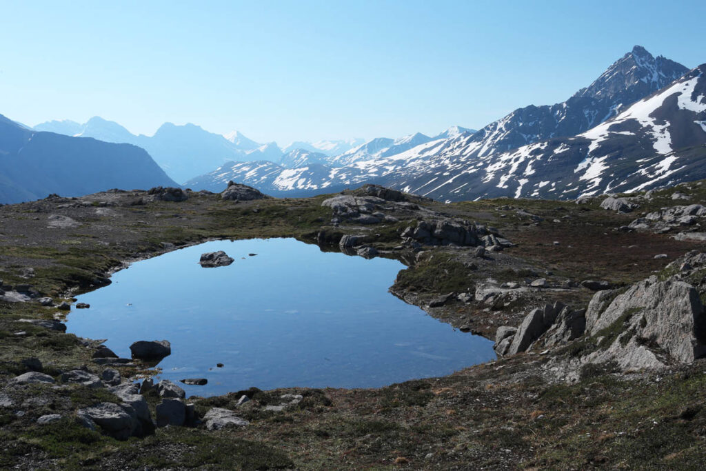
Wilcox Ridge.