Columbia Icefield Hiking
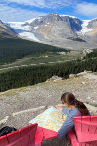
Columbia Icefield Map
Columbia Icefield hiking is the best way to experience the largest and most accessible glacial area in the Canadian Rockies. The Columbia Icefield is in the south end of Jasper National Park, 105 kilometres (65 miles) south from Jasper and 132 kilometres (82 miles) north from Lake Louise. Columbia Icefield hiking options include short trails to the Athabasca Glacier and more strenuous treks to lofty viewpoints. In fact, there are four hikes we recommend at the Columbia Icefield, each one detailed below and offering a different experience.
Before setting out, we recommend purchasing Gem Trek’s 1:75,000 Columbia Icefield Map, which lays out all Columbia Icefield hiking trails and is a handy reference for identifying landmarks in the region. It is available directly from the publisher through this link: Columbia Icefield Map, or at the Icefield Centre, as well as retail outlets throughout the Canadian Rockies.
Due to the dangers of crevasse and shifting ice, it is not permitted to venture onto the Athabasca Glacier without a guide. For information on how to spend time out on the glacier itself, visit this page: Can You Hike to the Columbia Icefield?
For information on Columbia Icefield geology and tours, visit this page: Columbia Icefield.
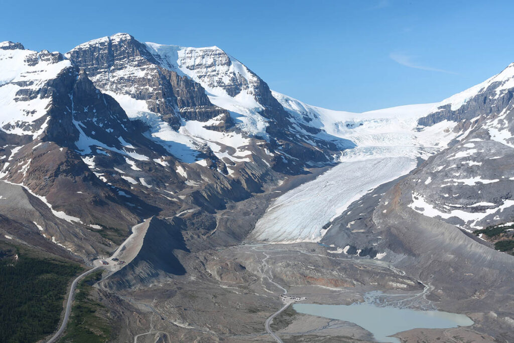
Columbia Icefield from Wilcox Ridge.
Forefield Trail
Length: 1.2 kilometres/0.7 miles (30 minutes) one way
Elevation loss: minimal
Rating: easy
Trailhead: Across highway from Icefield Centre
Across the road from the Icefield Centre is the trailhead for the Forefield Trail, which leads down through the forefield of the Athabasca Glacier, the barren area exposed by glacial melt since the 1840s. This trail gives you the unique experience of walking over moraine. Amid this strange landscape of bare rock, boulders and moraine, you will also see many hardy alpine plants that have gained a foothold in this harsh environment. Be aware that moraine is very rough and can be unstable, so take care not to twist an ankle. Wear sturdy shoes and bring a jacket and warm hat as the wind off the glacier is often chilly.
Forefield Trail.
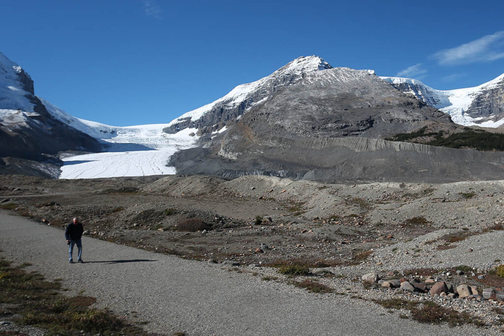
Toe of the Athabasca Glacier Trail
Length: 2.1 kilometres/1.3 miles (40 minutes) roundtrip
Elevation gain: minimal
Rating: easy
Trailhead: End of Road to the Glacier, which starts opposite the Icefield Centre
This easy trail offers the opportunity to get very close to a glacier with minimal effort. Do wear sturdy shoes and appropriate clothing as the wind off the glacier can be chilly.
From exhibits at the southeast corner of the parking lot, the trail crosses a footbridge over a meltwater stream from the glacier. The wide path then leads gently uphill, over glacially smoothed limestone surfaces that were under the ice in the 1950s.
The trail steepens and reaches the top of a rock bench where you can see the edge of the glacier ahead. You may be surprised at how dirty the ice looks. This is due to the large number of dust particles covering the surface. But just beneath the surface, the ice is a pristine white, with a beautiful translucent blue cast. From the trail’s high point, it loops back across a slab of rock overlooking Sunwapta Lake to the parking lot.
Wilcox Pass Trail
Length: 4 kilometres/2.5 miles (90 minutes) one-way
Elevation gain: 340 metres/1,115 feet
Rating: moderate
Trailhead: Wilcox Creek Campground, 3 kilometres (1.9 miles) south of the Icefield Centre
Views of the Columbia Icefield from the Icefields Parkway pale in comparison with those achieved along the Wilcox Pass Trail, on the same side of the valley as the Icefield Centre. This trail was once used by northbound outfitters because, 120 years ago, Athabasca Glacier covered the valley floor and had to be bypassed. Beginning from the Wilcox Creek Campground access road, the trail climbs through a stunted forest of Engelmann spruce and subalpine fir to a ridge with panoramic views of the valley, Mount Athabasca, and the Athabasca Glacier. Ascending gradually from there, the trail enters a fragile environment of alpine meadows. From these meadows and the pass, it’s worth continuing to WILCOX RIDGE (the distance quoted), from where views extend over the Columbia Icefield and surrounding peaks.
Parker’s Ridge Trail
Length: 2.4 kilometres/1.5 miles (1 hour) one-way
Elevation gain: 210 metres/690 feet
Rating: easy/moderate
Trailhead: Icefields Parkway, 6 kilometres (3.7 miles) south of the Icefield Centre
The Parker’s Ridge Trail starts south of the Icefield Centre and climbs to a ridgetop for views of the SASKATCHEWAN GLACIER, a southern arm of the Columbia Icefield. This trail doesn’t open until the snow melts, usually early or mid-July.
From the trailhead on the west side of the highway, this wide path gains elevation quickly through open meadows and scattered stands of subalpine fir. This fragile environment is easily destroyed, so it’s important that you stay on the trail. During the short alpine summer, these meadows are carpeted with red heather, white mountain avens, and blue alpine forget-me-nots. From the summit of the ridge, you look down on the two-kilometre-wide (1.2-mile-wide) Saskatchewan Glacier spreading out below.