Mount Assiniboine Hiking
Mount Assiniboine’s core area is one of the best hiking locales in the Canadian Rockies. For information on the two main trails leading into Mount Assiniboine Provincial Park, go to our Getting to Mount Assiniboine page.
For hikers, we recommend the Canadian Rockies Trail Guide by Brian Patton and Bart Robinson, which describes every trail in Mount Assiniboine Provincial Park in great detail, including access routes. Another good resource is Gem Trek’s waterproof Banff and Mount Assiniboine Map.
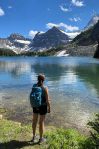
One of the most popular places to visit is MAGOG LAKE, close to the lodge, huts, and campground. It is possible to walk around the entire lake on an unofficial trail, but it’s also enjoyable to simply head down to the shoreline and enjoy the mountain views.
Below, we describe our favourite day hikes from Lake Magog. All distances below are from Assiniboine Lodge (N50°54.586’, W115°37.201’).
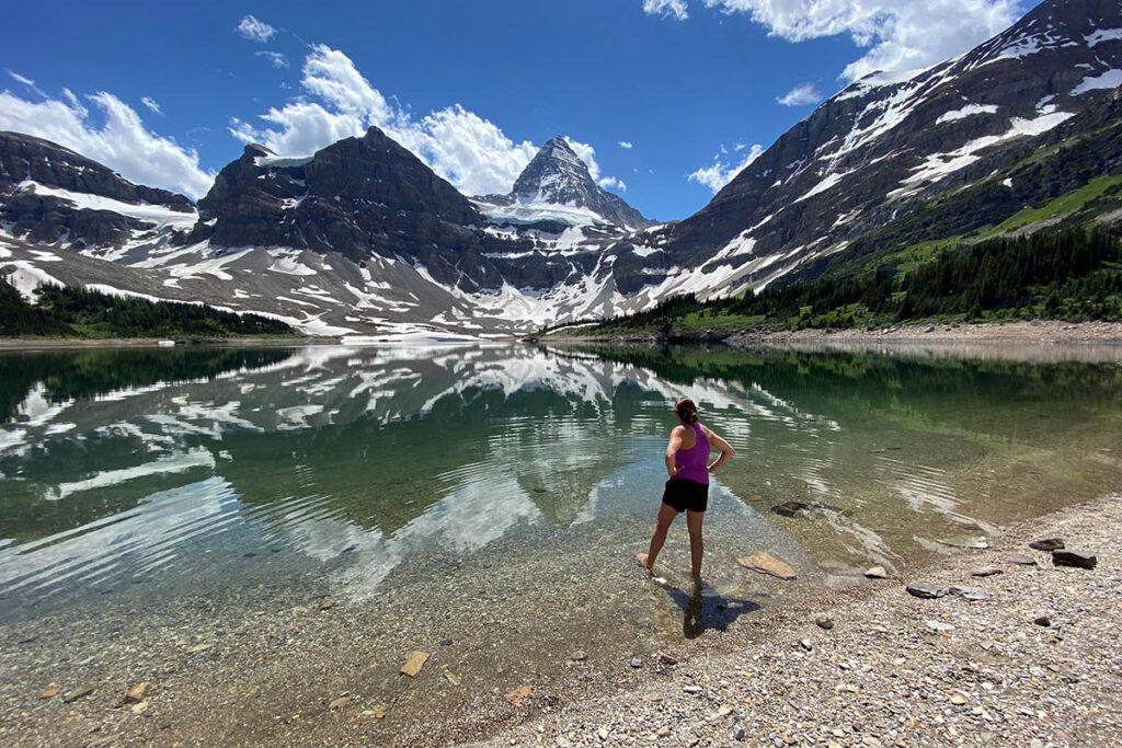
Magog Lake.
Wonder Pass
Length: 3.1 km/1.9 miles (1 hour) one-way
Elevation gain: 215 metres/700 feet
Rating: easy/moderate
Trailhead: Assiniboine Lodge
The hike to Wonder Pass from Lake Magog features Gog Lake, pure stands of alpine larch, vast wildflower meadows, and views that extend over much of Mount Assiniboine Provincial Park’s core area. And by extending the hike to a viewpoint on the slopes of Wonder Peak, you will discover marvelous views of Marvel Lake.
The trail begins its ascent to the pass from the Naiset Huts and follows a shallow vale southeast along Gog Creek. After crossing the creek, it comes abreast of Gog Lake. The lake lies beyond a marshy meadow beneath Naiset Point and is a pleasant place to relax on a sunny day. It is also a fine destination for evening walks from the lodge or the Naiset Huts.
Above the lake, the trail climbs in stages through alpine larch stands interspersed with open meadows. This is a particularly beautiful section during mid-September when the autumn gold of larch needles is most brilliant.
After climbing through the last stunted larch trees, the trail emerges into a vast, rolling alpine meadow leading to the summit of the pass. In the midst of this open landscape, you have your first good views back over the core area of Mount Assiniboine Provincial Park—vistas that stretch northward along the course of Og Valley to Citadel Pass and beyond. (You can even see the ski lifts on Lookout Mountain above Sunshine Village.)
Views into Banff National Park from the pass are limited by the slopes of Wonder Peak and The Towers, which create a narrow window south to mountains across the Marvel Lake valley.
While the views from Wonder Pass are wonderful, the pass takes its name from Wonder Peak, which was christened by interprovincial boundary surveyors who established a station on its summit in 1913. The wondrous view they had from the mountaintop was of Marvel Lake and Lake Gloria in Banff National Park—lakes that cannot be seen from Wonder Pass.
While you may not want to climb the peak to confirm the surveyors’ awe, you can continue beyond the pass for another 2 km (1.2 miles) to an open slope on the mountain and approximate their view.
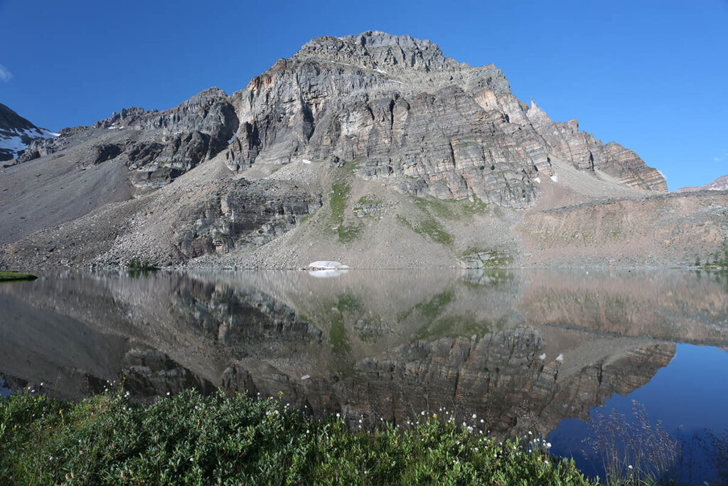
Gog Lake is along the Wonder Pass Trail.
Sunburst Valley
Length: 4.1 km/2.5 miles (1.5 hours) one-way
Elevation gain: 120 metres/400 feet
Rating: easy/moderate
Trailhead: Assiniboine Lodge
Sunburst Valley lies a short distance west of Lake Magog. The valley contains Sunburst and Cerulean Lakes and is reached on a flat, undemanding trail from either Assiniboine Lodge or Magog Campground. Most hikers include nearby Elizabeth Lake in their itinerary, and those looking for a longer outing continue up Nub Ridge.
From Assiniboine Lodge, follow the area’s core trail southwest along a plateau above Lake Magog. After 1.6 km (1 mile), the campground trail splits left, but you continue to the right through the forested vale leading to Sunburst Lake.
Sunburst Lake is a sparkling little gem set beneath the cliffs of Sunburst Peak. The trail follows its shoreline and immediately passes Sunburst Lake Cabin, which was built by Banff outfitter Pat Brewster in the mid-1930s. It was operated as a guest camp from 1951 to 1970 by Elizabeth “Lizzie” Rummel, and though it has been used as a residence for BC Parks staff in recent years, for those who knew this warm-hearted hostess, it will always belong to Lizzie.
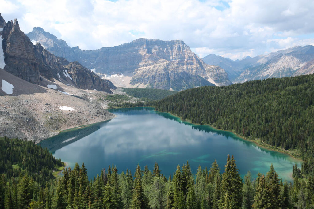
Only a narrow band of forest separates Sunburst from its larger neighbour Cerulean Lake. The trail stays near Cerulean’s northeast shore to a junction at its north end. While you can continue to the west end of the lake from this intersection, most hikers turn right and complete a short climb over a forested divide to tiny Elizabeth Lake—a pretty lake surrounded by alpine fir and larch that is named for Lizzie Rummel.
Nub Ridge
Length: 3.1 km/1.9 miles (1-1.5 hours) one-way
Elevation gain: 350 metres/1,150 feet
Rating: moderate
Trailhead: Assiniboine Lodge
One of the finest views of Mount Assiniboine is from the crest of the ridge leading to Nub Peak. The promontory is strategically situated just north of the Assiniboine group to provide a perfect panorama of all the peaks surrounding this magnificent pyramid and the lakes scattered near its base.
While a short 2.5-km hike reveals the classic, much-photographed view of Mount Assiniboine with Magog, Sunburst and Cerulean lakes from the Niblet, you can get an even higher perspective by continuing another 0.6 km along Nub Ridge to the Nublet—a 2530-m alpine platform immediately above the ridge to the north. And if you are really looking for a workout, scramble up the last step to the summit of Nub Peak (2743 m) for the full 360-degree overview of Mount Assiniboine Provincial Park’s core area.
From Assiniboine Lodge, follow the trail west 300 m and branch right onto the trail angling across the meadows toward Nub Ridge. You soon leave the meadows and begin a gradual climb through a forest of Engelmann spruce, alpine fir and scattered alpine larch.
The trail reaches the crest of the ridge and follows up along its backbone for another 200 metres to its highest point, known as the Niblet. From this viewpoint, the Assiniboine environs are spread like a map at your feet: a great wall formed by Wedgwood Peak, The Marshall and Mount Watson looms above the heavily forested shores of Wedgwood Lake to the southwest; Sunburst and Cerulean Lakes are wrapped around the rocky promontory of Sunburst Peak directly beneath the ridge to the south; and the sparkling waters of Lake Magog, Mount Assiniboine Provincial Park’s largest lake, stretch beneath the incomparable “horn” of Mount Assiniboine.
Continuing north, the trail makes a slight descent to the junction for the connector trail down to Sunburst Valley and Elizabeth Lake. The main trail continues ahead to the top of the Nublet, ascending through rocky bluffs and eventually entering a large alpine meadow. The Nublet isn’t really a peak but more of an extensive platform that allows a loftier view of Mount Assiniboine and the Lake Magog basin.
While the defined trail ends on the Nublet plateau, strong hikers can extend the journey upwards for another 1.6 km (1 mile) to the summit of Nub Peak—a steep but obvious scramble. While the foreground for Mount Assiniboine is not nearly as balanced and interesting from the peak as the Niblet and Nublet, views are more expansive, particularly to the Og Meadows–Og Lake environs immediately below the summit to the east.
If you haven’t already hiked to Sunburst Valley (see above) and Elizabeth Lake, this is a logical way to return from Nub Ridge. The option only adds 2.2 km (1.4 miles) to the return trip and allows you to visit all the lakes on the Sunburst Valley route.
Windy Ridge
Length: 7.4 km/4.6 miles (2-2.5 hours) one-way
Elevation gain: 470 metres/1,550 feet
Rating: moderate
Trailhead: Assiniboine Lodge
The trail to Windy Ridge provides an expansive panorama of Mount Assiniboine and the Lake Magog basin, and the wildflower meadow on the slopes below Windy Ridge is one of the finest in the Rockies.
From the lodge, follow the Og Lake trail north. After descending a shallow vale, you emerge onto the vast, open expanse of Og Meadows, where the trail to Windy Ridge splits right.
From the meadows, the trail ascends through a subalpine forest before leveling off into the one-km-long Og Pass. A short side-trip to the east will bring you to the true summit of Og Pass, although travel east of Og Pass is restricted most of the summer (see here)
While the trip to Windy Ridge becomes more strenuous beyond Og Pass, the views are increasingly rewarding as you ascend the west slope of Og Mountain.
On an open slope beyond Og Pass, there is a fantastic panorama that stretches from the peaks of the Assiniboine group to Yoho National Park’s twin-towered Goodsir Peak on the northwestern horizon. In mid-summer, this slope is covered with the colourful blooms of forget-me-nots, arnica, contorted lousewort, golden fleabane, alpine speedwell, red-stemmed saxifrage, and moss campion.
After one last uphill grunt over a steep scree slope, the trail crests a high saddle just below Og Mountain’s summit. From this crest, you have a mountaineer’s-eye view of the ranges to the east and the upper Brewster Creek valley. A dizzy precipice drops away from the eastern lip of Windy Ridge, where you can peer warily down between your toes to a beautiful hanging valley cradling a tiny azure lake.