Kananaskis Country History
The history of the name Kananaskis Country dates to 1858, when Captain John Palliser bestowed the name Kananaskis on the valley, a pass, and two lakes. Kananaskis was a native who, legend had it, suffered a vicious blow to the head by an enemy but survived. The word itself is thought to mean “the meeting of the water.” Aside from Palliser, Kananaskis Country was visited by many names synonymous with exploration of the Canadian Rockies: David Thompson in 1787 and 1800, Peter Fidler in 1792, and James Sinclair leading Scottish settlers to the Oregon Territory in 1841. Throughout these times, and until recent times, the valley remained mostly uninhabited.
Logging took place from 1883, mostly in the foothill valleys of the Elbow and Sheep Rivers. Coal was mined at various sites, including Ribbon Creek, by Kananaskis Village, but never on a large scale. To serve these industries, roads were built, including the Forestry Trunk Road (Highway 40), which traverses the entire foothills parallel to the Continental Divide. Between 1939 and 1946, an internment camp overlooking Barrier Lake held up to 1,000 German civilians and soldiers. Some buildings still remain, including a guard’s tower.
During Alberta’s oil-and-gas boom of the 1970s, oil revenues collected by the provincial government were placed into the Heritage Savings Trust Fund, from where they were channeled into various projects aimed at improving the lifestyle of Albertans. One lasting legacy of the fund is Kananaskis Country, officially designated by premier Peter Lougheed in 1977 as Kananaskis Country Provincial Recreational Area. The mandate was to accommodate a multitude of uses, including primarily recreational pursuits, but Kananaskis Country also holds 21 active oil and gas leases, 14 grazing permits, and a hydroelectric station on the Kananaskis River. Timber extraction leases have been in place in Kananaskis Country since the 1940s, and their contentious nature surfaced most recently in 2006 when a local company applied to begin harvesting an area west of Bragg Creek. Since 1977, the provincial government has pumped more than $300 million into Kananaskis Country, with private investors spending a little more than $80 million in that same period. Kananaskis Village was developed in the early 1980s in anticipation of the 1988 Winter Olympic Games. The first major boundary change since 1977 occurred in early 1996 when Elbow-Sheep Wildland Provincial Park was established; at 76,900 hectares (190,000 acres), it is Alberta’s largest provincial park. A couple of years later saw the declaration of Spray Valley Provincial Park, which created a continuous stretch of protection for the Canadian Rockies from Willmore Wilderness Park in the north to Peter Lougheed Provincial Park in the south.
2013 Kananaskis Country Floods
Although there have been no official boundary changes since the creation of Spray Valley Provincial Park in 1998, massive changes were made to the landscape during floods that devastated Kananaskis Country in June 2013. Many road and trail bridges were washed out, Kananaskis Country Golf Course required a complete rebuild, and a number of popular recreation spots—such as Allen Bill Pond—were destroyed completely.
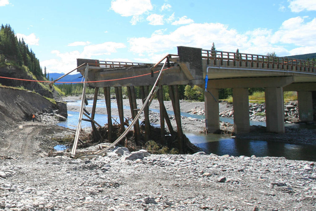
Many bridges were washed out by flooding in 2013.