Kananaskis Country Hiking
Kananaskis Country is laced with around 1,300 km of hiking trails ranging from short interpretive trails to strenuous full-day hikes. Most trailheads are along Highway 40 and in Peter Lougheed Provincial Park. Our team has hiked most Kananaskis Country hiking trails and these are our favourites:
Before setting off on any hikes, whatever the length, go to a park information centre for Kananaskis Country maps, trail conditions, and trail closures. You should also consider purchasing a copy of the Canadian Rockies Trail Guide, by Brian Patton and Bart Robinson. This hiking book is available directly from Summerthought Publishing by following this link: Canadian Rockies Trail Guide.
Prairie View Trail
Length: 6.5 km (2 to 2.5 hours) one-way
Elevation gain: 420 metres
Rating: moderate
Trailhead: north end of Barrier Lake, Highway 40
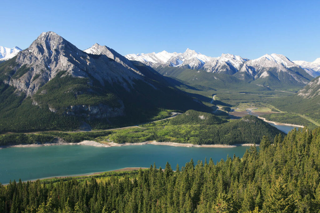
This trail provides a variety of options; the most straightforward leads to a high viewpoint atop McConnell Ridge. To get started, cross the Barrier Dam, take the right fork at the first junction, and go left at the second. From this point the trail climbs steadily along an old fire lookout road to the summit, where views extend south across Barrier Lake to Mount Baldy. The actual site of the fire lookout is one kilometre farther and 80 vertical metres from the main trail along the ridge. The additional climb to the lookout is well worth the effort; you’ll be rewarded with views across Bow Valley to Mount Yamnuska and east across the prairies to Calgary. Back on the main trail, at the 6.5-kilometre mark, you’ll come to Jewell Pass, a major trail junction. The options from this point are to descend along Jewell Creek to the shore of Barrier Lake, passing picturesque Jewell Falls (14 km round-trip from the parking lot; allow four hours), or to continue north into the Quaite Valley and to the Heart Creek trailhead in the Bow Valley (a further 8 km one-way).

Barrier Lake from Prairie View Lookout.
Mount Allan (Centennial Ridge) Trail
Length: 11 km (4 to 5 hours) one-way
Elevation gain: 1,350 metres
Rating: difficult
Trailhead: upper parking lot at Ribbon Creek
This is the highest maintained trail in the Canadian Rockies and one of the few that actually reach a mountaintop. Its final destination is the summit of Mount Allan, on whose slopes the Nakiska ski area lies. From the marked trailhead, it branches to the right, through the Hidden Ski Trail, then left through an open meadow that was the site of the Ribbon Creek Coal Mine. Then the fun starts—the trail gains 610 metres of elevation in the next two km. At the end of this climb the trail arrives atop Centennial Ridge and at the top of the Olympic Platter, starting point for the Men’s Downhill at the 1988 Winter Olympic Games. It follows the ridge past a group of intriguing 25-metre-high hoodoos known as the Rock Garden, passes a false summit, and then, finally, reaches the top of 2,990-metre Mount Allan.
Rawson Lake Trail
Length: 3.5 kilometre (1.5 hours) one-way
Elevation gain: 305 metres
Rating: moderate
Trailhead: Upper Lake day-use area, Kananaskis Lakes Road, 13 km from Highway 40
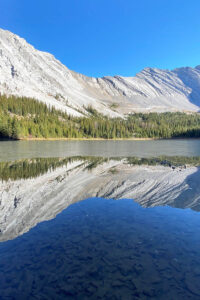
This picturesque subalpine lake is one of the most rewarding half-day hiking destinations in Kananaskis Country. It sits in a high cirque and is backed by a towering yet magnificently symmetrical headwall, so it’s easy to spend an hour or two soaking up your surroundings once you reach the end of the trail. Snow lies along the trail well into July, and the lake doesn’t open for fishing until July 15, but it is nevertheless a popular destination throughout summer. Make your way to the farthest parking lot at Upper Lake (through the middle of the main parking lot) and begin the trek by taking the Upper Kananaskis Lake Circuit Trail. Sarrail Creek Falls is passed at the one-kilometre mark, 150 metres before the Rawson Lake cutoff. Taking the uphill option, you’re faced with almost two km of switchbacks. The trail then levels out, with boardwalks constructed over boggy sections of trail, suddenly emerging at the lake’s outlet. Continue around the southern shore, past an intriguing elevated outhouse, to small meadows and slopes of scree that disappear into the lake.
Elbow Lake Trail
Length: 1.3 km (30 minutes) one-way
Elevation gain: 135 metres
Rating: easy
Trailhead: Elbow Pass day-use area, Highway 40, 13 km south of Kananaskis Lakes Road
The official trail is a wide road that climbs quickly into the bowl holding shallow Elbow Lake. The lake is a popular spot, especially for summer picnics; campsites are spread around the south shore. An interesting side trip is to Rae Glacier, a small glacier on the north face of Mount Rae. The trail starts on the east shore of the lake, gaining 400 metres of elevation in just over two km. Elbow Lake is the source of the Elbow River, which flows eastward through Elbow-Sheep Wildland Provincial Park and into the foothills. The short hiking trail from Highway 40 up to the lake is part of a much longer historic route that ran between the two valleys and is still passable for backcountry adventurers.
Burstall Pass Trail
Length: 7.4 km (2.5 hours) one-way
Elevation gain: 480 metres
Rating: moderate/difficult
Trailhead: Mud Lake, Smith-Dorrien/Spray Trail, 20 km from Kananaskis Lakes Road
From Mud Lake (a popular fishing hole), this trail begins with a three-kilometre (1.9-mile) climb up an old logging road to Burstall Lakes. After traversing some willow flats, it begins climbing again through heavy forest and across avalanche paths to a large cirque. The final ascent to the pass is a real slog, but the view across the Upper Spray Valley (which is in Banff National Park) is worth it.
Watridge Lake Trail
Length: 3.5 km (1 hour) one-way
Elevation gain: 50 metres
Rating: easy
Trailhead: Follow the Smith-Dorrien/Spray Trail 40 km south from Canmore, then head 5 km west to the Mount Shark staging area.
Most of the hiking in Spray Valley Provincial Park requires some route finding; Watridge Lake is the exception and is open to mountain bikes. The trail begins from behind the information board at the entrance to the main parking lot, skirting a maze of cross-country ski trails and quickly reaching the muddy shoreline of the lake, which is known for excellent cutthroat trout fishing. Dedicated anglers stop here; most other hikers cross the lake’s outlet to the left and continue 900 metres (allow 20 minutes one-way) to a delightful spring that bursts from the forested slopes of Mount Shark and flows along a riverbed carpeted in moss.
Moose Mountain Trail
Length: 7 km (2.5 to 3 hours) one-way
Elevation gain: 670 metres
Rating: moderate/difficult
Trailhead: 7 km along an unmarked gravel road that spurs north of Highway 66, 700 metres west of Paddy’s Flat Campground
Rising to an elevation of 2,438 metres, Moose Mountain is the dominant peak in the Elbow River Valley area. Its summit provides 360-degree views over the entire region. From 500 metres before a gate across the road, the trail follows an old fire-lookout road for four km, climbing steadily just below the ridgeline. It then descends before climbing again into an open meadow. Here begins the relentless slog to the domelike lower summit, from where it’s another 100 vertical metres, via switchbacks or a direct climb up a ridge, to the upper summit and fire lookout.
Picklejar Lakes Trail

Picklejar Lakes.
Length: 4.2 km (90 minutes) one-way
Elevation gain: 470 metres
Rating: moderate
Trailhead: Lantern Creek day-use area, 3 km south of the Mist Creek day-use area, Highway 40
The name of these lakes was coined by early anglers, who claimed fishing them was as “easy as catching fish in a pickle jar.” The name stuck, and it’s still mostly anglers who are attracted to the four lakes. They lie at the southern end of Elbow-Sheep Wildland Provincial Park. To access the trail, cross the road from Lantern Creek day-use area and walk up the hill 100 metres. The trail is easy to follow as it passes through a lightly forested area and open meadows to a ridge above Picklejar Creek. The trail climbs the spine of the ridge for a short way. From the top of the ridge, the first lake is 300 metres of steep downhill walking across a scree slope. The trail continues uphill past two more lakes before ending at the fourth, which is the largest and has incredibly clear water. A lightly marked trail encircles the fourth lake.
