Icefields Parkway Hiking
Canadian Rockies Trail Guide.
Icefields Parkway hiking trails range from short interpretive walks to overnight treks. These are our favourite day hikes, listed from south to north.
Before attempting any hikes, visit visitor centres in Banff, Lake Louise, or Jasper, where staff can advise you on the condition of trails and closures. The Canadian Rockies Trail Guide, by Brian Patton and Bart Robinson, covers every Icefields Parkway hiking trail in great detail. Another source of information is the Canadian Rockies Hiking Blog, by the same two authors. We also have details of hikes near the Columbia Icefield on this page: Columbia Icefield Hiking
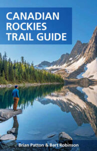
Helen Lake Trail
Length: 6 kilometres/3.7 miles (2.5 hours) one-way
Elevation gain: 455 metres/1,500 feet
Rating: moderate
Trailhead: across the Icefields Parkway from Crowfoot Glacier Lookout, 33 kilometres (20 miles) northwest from the junction with the TransCanada Highway
The trail to Helen Lake is one of the easiest ways to access a true alpine environment from the southern end of the Icefields Parkway. The trail climbs steadily through a forest of Engelmann spruce and subalpine fir for the first 2.5 kilometres (1.6 miles) to an avalanche slope, reaching the tree line and the first good viewpoint after three kilometres (1.9 miles). The view across the valley is spectacular, with Crowfoot Glacier visible to the southwest. As the trail reaches a ridge, it turns and descends into the glacial cirque where Helen Lake lies. Listen and look for hoary marmots around the scree slopes along the lakeshore.
For those with the time and energy, it’s possible to continue an additional three kilometres (1.9 miles) to DOLOMITE PASS; the trail switchbacks steeply up a further 100 vertical metres (330 vertical feet) in less than one kilometre (0.6 mile), then descends steeply for a further one kilometre (0.6 mile) to KATHERINE LAKE and beyond to the pas
Helen Lake.
Bow Glacier Falls Trail
Length: 3.4 kilometres/2.1 miles (1 hour) one-way
Elevation gain: 130 metres/430 feet
Rating: easy
Trailhead: Lodge at Bow Lake, Bow Lake, 36 kilometres (22.3 miles) northwest from the TransCanada Highway
This hike skirts one of the most beautiful lakes in the Canadian Rockies before ending at a narrow but spectacular waterfall. From the parking lot in front of the Lodge at Bow Lake, follow the shore through Willow Flats to a gravel outwash area at the end of the lake. Across the lake are reflected views of Crowfoot Mountain and, farther west, a glimpse of Bow Glacier among the jagged peaks of the Waputik Range. The trail then begins a short but steep climb up the rim of a canyon before leveling out at the edge of a vast moraine of gravel, scree, and boulders. This is the end of the trail, although it’s possible to reach the base of Bow Glacier Falls by picking your way through the 800 metres (0.5 mile) of rough ground that remains
Peyto Lake Trail
Length: 1.4 kilometres/0.9 mile (30 minutes) one-way
Elevation loss: 100 metres/330 feet
Rating: easy
Trailhead: unmarked pullout, Icefields Parkway, 2.4 kilometres (1.5 miles) north of Bow Summit
Without a doubt, the best place to view Peyto Lake is from a popular viewpoint accessible via a short trail from Bow Summit, 41 kilometres (25.5 miles) along the Icefields Parkway from the TransCanada Highway. The easiest way to access the actual shoreline, though, is along this short trail farther along the highway. A pebbled beach, strewn with driftwood, is the perfect setting for picnicking, painting, or just admiring the lake’s quieter side. Back at the lake lookout, a rough trail drops nearly 300 metres (980 feet) in 2.4 kilometres (1.5 miles) to the lake
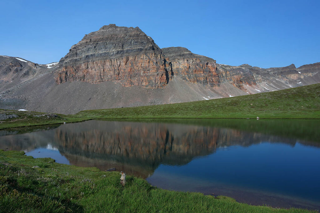
Chephren Lake Trail
Length: 4 kilometres/2.5 miles (60<#208>90 minutes) one-way
Elevation gain: 100 metres/330 feet
Rating: easy
Trailhead: Waterfowl Lake Campground, Icefields Parkway, 57 kilometres (35 miles) northwest from the TransCanada Highway
This pale-green body of water (pronounced Kef-ren) is hidden from the Icefields Parkway but easily reached. The official trailhead is a bridge across the Mistaya River at the back of Waterfowl Lakes Campground (behind site 86). If you’re not registered at the campground, park at the end of the unpaved road running along the front of the campground and walk 300 metres (0.2 mile) down the well-worn path to the river crossing. From across the river, the trail dives headlong into a subalpine forest, reaching a crudely signposted junction after 1.6 kilometres (one mile). Take the right fork. This leads 2.4 kilometres (1.5 miles) to Chephren Lake, descending steeply at the end (this stretch of trail is often muddy). The lake is nestled under the buttresses of Mount Chephren. To the left—farther up the lake—is Howse Peak.
The trail to smaller CIRQUE LAKE (4.5 km/2.8 miles from the trailhead) branches left 1.6 kilometres (one mile) along this trail. It is less heavily used, but this lake is popular with anglers for its healthy population of rainbow trout.
Chephren Lake.
Glacier Lake Trail
Length: 9 kilometres/5.6 miles (2.5<#208>3 hours) one-way
Elevation gain: 220 metres/770 feet
Rating: moderate
Trailhead: an old gravel pit on the west side of the highway, 1 kilometre (0.6 mile) west of Saskatchewan River Crossing
This three-kilometre-long (1.9-mile-long) lake is one of the park’s largest lakes not accessible by road. Although not as scenic as the more accessible lakes along the parkway, it’s a pleasant destination for a full-day or overnight trip. For the first one kilometre (0.6 mile), the trail passes through an open forest of lodgepole pine to a fancy footbridge across the rushing North Saskatchewan River. From there it climbs gradually to a viewpoint overlooking Howse River and the valley beyond, then turns away from the river for a long slog through dense forest to Glacier Lake. A primitive campground lies just over 300 metres (0.2 mile) from where the trail emerges at the lake.
Saskatchewan Glacier Trail
Length: 7.3 kilometres/4.5 miles (2 hours) one-way
Elevation gain: 150 metres/490 feet
Rating: moderate
Trailhead: small parking lot, 35 kilometres (22 miles) northwest of the Saskatchewan River Crossing (just before the highway begins its “Big Bend” up to Sunwapta Pass)
The Saskatchewan Glacier, a tongue of ice from the great Columbia Icefield, is visible from various points along the Icefields Parkway. This hike will take you right to the toe of the glacier. After crossing an old concrete bridge, the trail disappears into the forest to the right, joining an overgrown road and continuing up the valley along the south bank of the river. When the toe of the glacier first comes into sight it looks deceptively close, but it’s still a long hike away over rough terrain
Nigel Pass Trail
Length: 7.4 kilometres/4.6 miles (2.5 hours) one-way
Elevation gain: 365 metres/1,200 feet
Rating: moderate
Trailhead: Icefields Parkway, 2.5 kilometres (1.6 miles) north of the switchback on the “Big Bend”
Park on the east side of the highway and follow the gravel road to a warden cabin, around 1.6 kilometres (one mile) from the trailhead. Turn right here and cross two small creeks then climb a creek bank to a stand of Engelmann spruce and subalpine fir two kilometres (1.2 miles) from the trailhead. This is an old campsite used first by Indigenous hunting parties, then by mountaineers exploring the area around the Columbia Icefield. Look for carvings on trees recording these early visitors. From here the trail continues to climb steadily, only increasing in gradient for the last one kilometre (0.6 mile) to the pass. The pass (2,195 metres/7,200 feet) marks the boundary between Banff and Jasper National Parks. For the best view, scramble over the rocks to the left. To the north, the view extends down the Brazeau River Valley, surrounded by a mass of peaks. To the west (left) is Nigel Peak (3,211 metres/10,535 feet), and to the southwest are views of Parker’s Ridge and the glaciated peaks of Mount Athabasca.
Parker’s Ridge Trail
Length: 2.4 kilometres/1.5 miles (1 hour) one-way
Elevation gain: 210 metres/690 feet
Rating: easy/moderate
Trailhead: Icefields Parkway, 4 kilometres (2.5 miles) south of Sunwapta Pass
From the trailhead on the west side of the highway, this wide path gains elevation quickly through open meadows and scattered stands of subalpine fir. This fragile environment is easily destroyed, so it’s important that you stay on the trail. During the short alpine summer, these meadows are carpeted with red heather, white mountain avens, and blue alpine forget-me-nots. From the summit of the ridge, you look down on the two-kilometre-wide (1.2-mile-wide) Saskatchewan Glacier spreading out below. Beyond is Castleguard Mountain, renowned for its extensive cave system.
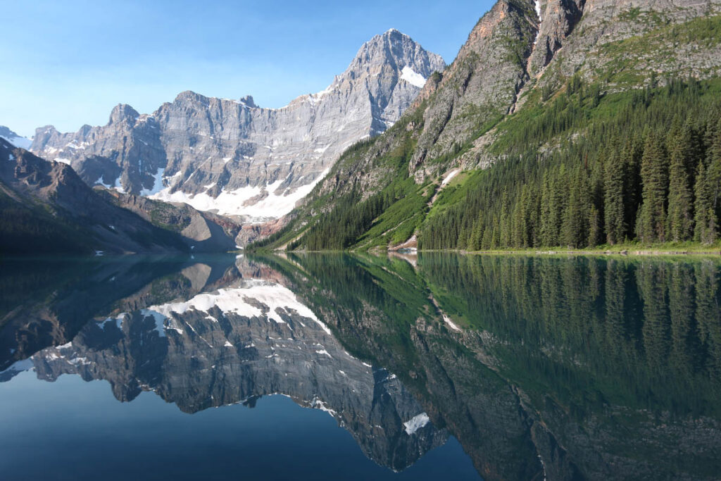
Wilcox Pass Trail
Length: 4 kilometres/2.5 miles (90 minutes) one-way
Elevation gain: 340 metres/1,115 feet
Rating: moderate
Trailhead: Wilcox Creek Campground, 3 kilometres (1.9 miles) south of the Icefield Centre
Views of the Columbia Icefield from the Icefields Parkway pale in comparison with those achieved along this trail, on the same side of the valley as the Icefield Centre. This trail was once used by northbound outfitters because, 120 years ago, Athabasca Glacier covered the valley floor and had to be bypassed. Beginning from the Wilcox Creek Campground access road, the trail climbs through a stunted forest of Engelmann spruce and subalpine fir to a ridge with panoramic views of the valley, Mount Athabasca, and the Athabasca Glacier. Ascending gradually from there, the trail enters a fragile environment of alpine meadows. From these meadows and the pass, it’s worth continuing to WILCOX RIDGE (the distance quoted), from where views extend over the Columbia Icefield and surrounding peaks.
Wilcox Pass.
Valley of the Five Lakes Trail
Length: 2.3 kilometres/1.4 miles (40 minutes) one-way
Elevation gain: 60 metres/200 feet
Rating: easy
Trailhead: Icefields Parkway, 10 kilometres (6.2 miles) south of the town of Jasper
These lakes, nestled in an open valley, are small but make a worthwhile destination. From the trailhead, 10 kilometres (6.2 miles) south of town along the Icefields Parkway, the trail passes through a forest of lodgepole pine, crosses a stream, and climbs a ridge from where you’ll have a panoramic view of surrounding peaks. As the trail descends to the lakes, turn left at the first intersection to a point between two of the lakes. These lakes are linked to Old Fort Point by a tedious 10-kilometre (6.2-mile) trail through montane forest.
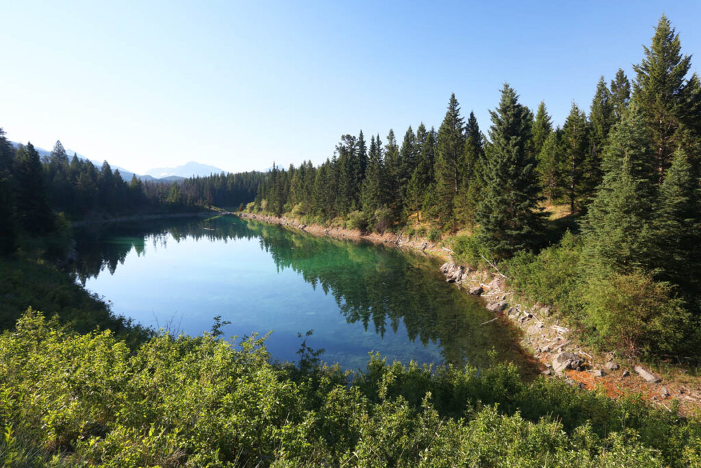
Valley of the Five Lakes.