Kananaskis Country Scenic Drives
Kananaskis Country scenic drives mean you don’t need to travel deep into the backcountry to view the most spectacular features—many are visible from the roadside.
Kananaskis Country is not served by any form of public transportation, nor are there guided tours. Instead, drive your own vehicle or a rental and head west from Calgary or east from Banff along the TransCanada Highway. The main access point is equidistant from both (around 50 minutes), from where Highway 40 heads south into the heart of Kananaskis Country. If you’re based in Canmore, Banff, or even Calgary, you can easily visit Kananaskis Country in a day, spending your time sightseeing and hiking along Highway 40, then looping back to the TransCanada Highway via the Smith Dorrien Trail through Spray Valley Provincial Park to Canmore.
Kananaskis Valley
This is the most developed area of Kananaskis Country, yet summer crowds are minimal compared to Banff. Highway 40 follows the Kananaskis River through the valley between the TransCanada Highway and Peter Lougheed Provincial Park. From the TransCanada Highway, 76 km west of Calgary, Highway 40 branches south across open rangeland, entering Kananaskis Country beyond the boundary of the Stoney reserve. The first worthwhile stop along this route is CANOE MEADOWS, a large day-use area above the sparkling Kananaskis River. Below the picnic area, white-water enthusiasts use a short stretch of river as a slalom course. Man-made obstacles and gates challenge recreational and racing kayakers, while upstream (around the first bend), the man-made Green Tongue creates a steep wave, allowing kayakers to remain in one spot, spinning and twisting while water rushes past them.
South from Canoe Meadows, stop at the KANANASKIS VISITOR INFORMATION CENTRE (403/673-3985) for park information and to browse the small selection of books. Nestled between Highway 40 and the Kananaskis River, riverside trails lead in both directions, including two km downstream to Canoe Meadows. Across the road is TIM HORTON’S CHILDREN’S RANCH, set up to help underprivileged kids enjoy summer camp. The first main body of water Highway 40 passes is BARRIER LAKE, dominated to the south by the impressive peak of Mount Baldy (2,212 metres). The lake is man-made but still a picture of beauty. From a picnic area at its northern end, an official trail leads across the dam, but just as enjoyable is to walk along the southern lakeshore below the highway. Along its length are stretches of sandy beach, small streams, piles of driftwood, and at the end of the lake a massive scree slope that disappears into the lake. Opposite Barrier Lake is the BIOGEOSCIENCES INSTITUTE, a University of Calgary forestry research station which has been in use since the 1930s. A cabin from this early era still stands, along with a guard’s tower put in place during World War II when the facility was used as an internment camp. The cabin is also the starting point for the Forestry Management Interpretive Trail, comprising two interconnected loops that describe the forest and forestry practices.
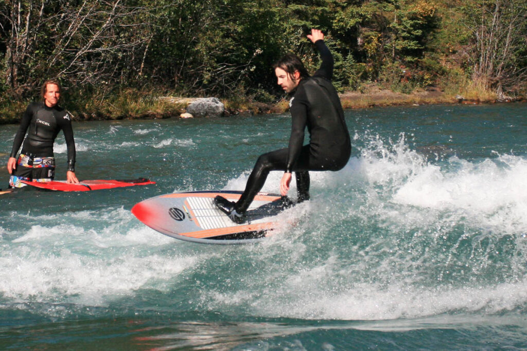
Surfer at Canoe Meadows.
After passing a second, lesser-used picnic area at the south end of Barrier Lake, Highway 40 continues south around the base of Mount Baldy and crosses Wasootch Creek and another picnic area. The next stop of interest,
especially for young anglers, is MOUNT LORETTE PONDS, a string of five shallow lakes stocked annually with rainbow trout. Originally an oxbow in the Kananaskis River, these lakes were artificially deepened when the construction of Highway 40 cut them off from the main flow of the Kananaskis River. Paved paths lead to and around the ponds, passing quiet picnic spots and wheelchair-accessible fishing platforms.
KANANASKIS VILLAGE lies just off Highway 40, four km south of the ponds. The village was the epicentre of action during the 1988 Winter Olympic Games. Developed specially for the games, the village sits on a high bench below Nakiska—where the downhill events of the games were held—and overlooks the valley. The village comprises two hotels, restaurants, and other service shops set around a paved courtyard complete with waterfalls and trout-stocked ponds. From the village, it’s 15 km farther south to the border of Peter Lougheed Provincial Park. Just beyond the village is WEDGE POND. Originally dug as a gravel pit during golf course construction, it is now filled with water and encircled by a one-kilometre (0.6-mile) trail offering fantastic views across the river to towering 2,958-metre (9,700-foot) Mount Kidd.
Peter Lougheed Provincial Park
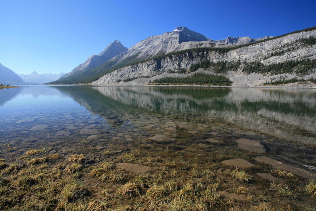
This park is a southern extension of the Kananaskis Valley and protects the upper watershed of the Kananaskis River. It is contained within a high mountain valley and dominated by two magnificent bodies of water: UPPER AND LOWER KANANASKIS LAKES. To the west and south is the Continental Divide and British Columbia, while to the north is Spray Valley Provincial Park and to the east is Elbow-Sheep Wildland Provincial Park. Originally named Kananaskis Provincial Park, it was renamed in 1986 after Peter Lougheed (pronounced LAW-heed). Lougheed was the Albertan premier who, with the help of oil-money-based Heritage Savings Trust Fund, began the development of Kananaskis Country as a multiuse recreation area. The 500-square-kilometre wilderness area is the second-largest provincial park in Alberta.
The most important intersection to make note of is five km along Highway 40 from the park’s north boundary. At this point, Kananaskis Lakes Trail branches off to the west, accessing Upper and Lower Kananaskis Lakes. These two lakes are the centre of boating and fishing in the park, and opportunities abound for hiking and camping nearby.
Highway 40 over Highwood Pass
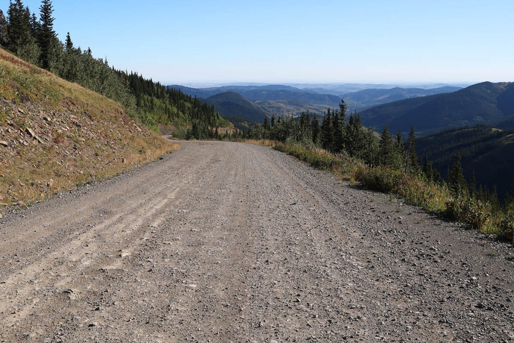
Beyond the turnoff to Peter Lougheed Provincial Park, Highway 40 climbs to Highwood Pass (2,227 metres), the highest road pass in Canada. On the way up to the pass, a pleasant detour is VALLEY VIEW TRAIL, a five-kilometre paved road whose route higher up the slopes of the Opal Range allows views across the entire park to the Continental Divide. The pass itself is right at the tree line, making it one of the most accessible alpine areas in all of the Canadian Rockies. Simply step out of your vehicle and follow the interpretive trails through the HIGHWOOD MEADOWS. In the vicinity, the Rock Glacier Trail, two km north of Highwood Pass, leads 150 metres to a unique formation of moraine rock. From the pass, Highway 40 descends into the Highwood/Cataract Creek areas of Kananaskis Country (Highwood Junction is 35 km from the pass).
Note: The road over Highwood Pass is closed from December to mid-June as it passes through critical wildlife habitat.
Smith-Dorrien/Spray Trail through Spray Valley Provincial Park
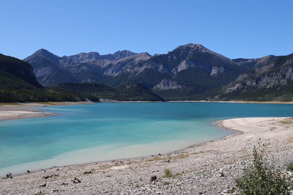
The 60-kilometre unpaved (and often dusty) Smith-Dorrien/Spray Trail (known as Spray Lakes Road from the Canmore end) links Peter Lougheed Provincial Park in the south to Canmore in the north. From the south, the road climbs up the Smith-Dorrien Creek watershed, passing MUD LAKE and entering Spray Valley Provincial Park just south of Mount Engadine Lodge (see Kananaskis Country Hotels). Around three km farther north is BULLER POND (on the west side of the road), from where the distinctive “Matterhorn” peak of Mount Assiniboine can be seen on a clear day. The road then parallels the eastern shoreline of SPRAY LAKE for more than 20 km, passing three lakefront picnic areas. This 26-kilometre-long (16-mile-long) body of water is an integral part of a massive hydroelectric scheme. The Spray Development began in 1948 with the construction of a road between Canmore and the Spray River. The next stage was damming the river, creating a reservoir of approximately 2,000 hectares, then diverting its course through Whiteman’s Pass and using the water flow as it drops into the Bow River to generate hydroelectric power. The water drops a total of 300 vertical metres and passes through three power plants, which combined generate enough electricity to power a city of 100,000. The mountains that rise steeply to the east are the same ones visible to the west driving along the Kananaskis Valley. They rise to a high point of 3,121 metres at Mount Sparrowhawk (opposite the picnic area of the same name), which was roundly recommended as having better slopes than the barely adequate Mount Allan for hosting the downhill-skiing events of the 1988 Winter Olympics. In the end, its remote location killed the idea and any development was spared, except for a few lakeside picnic tables across the road. Beyond the north end of Spray Lake, the road passes GOAT POND, then descends steeply into the Bow Valley and Canmore. The obvious loop – south from the TransCanada Highway along Highway 40 to Peter Lougheed Provincial Park, then north through Spray Valley Provincial Park to Canmore and back along the TransCanada Highway to Highway 40 – is 150 km; allow at least three hours for the entire loop.
Spray Lake.
Highway 68 through the Sibbald Valley
The Sibbald area in the north of Kananaskis Country protects the rolling foothills that descend to the rich grazing land west of Calgary. Access is along partly paved Highway 68, which branches south off the TransCanada Highway 17 km west of the Cochrane intersection. Access is also possible from the west, off Highway 40 two km south of the Barrier Lake Visitor Information Centre. From the east, Highway 68 climbs through the JUMPING POUND CREEK watershed to Jumpingpound Demonstration Forest, 18 km from the highway. The forest is circled by a 10-kilometre driving tour, with signs identifying species in the surrounding forest. It also passes a portable sawmill, a small picnic area, and a wetland. Meanwhile, Highway 68 continues westward, passing a turnoff to SIBBALD LAKE, the Ole Buck Loop and Deer Ridge Circuit Trails, a picnic area, and a campground. It then crosses a low divide (look for impressive beaver ponds on the south side of the road) and descends through a narrow valley to Highway 40, the main route through Kananaskis Country.
Barrier Lake.
Highway 66 through the Elbow River Valley
Once a beloved day-use area, Allen Bill Pond was destroyed by the 2013 floods and the Elbow River has now reverted to its original course.
The Elbow River has its source at Elbow Lake, among the high peaks of ELBOW-SHEEP WILDLAND PROVINCIAL PARK. As it cuts east through the foothills, the Elbow River Valley gradually opens up, exiting Kananaskis Country near the picturesque hamlet of Bragg Creek and continuing its eastward flow, draining into the Bow River within Calgary city limits. (The “elbow” for which the river was named by David Thompson in 1814 occurs at what is now Glenmore Reservoir, the source of Calgary’s drinking water.) The main access is Highway 66 (Elbow Falls Road) west of BRAGG CREEK. It enters Kananaskis Country after eight km, at the Elbow River Valley Visitor Centre. This area experienced severe flood damage in June 2013 and the bridge over the Elbow River was destroyed (it has since been replaced). Flood damage can also be viewed further west at what were once McLean and Allen Bill Ponds, but that has been reclaimed by the Elbow River. MOOSE MOUNTAIN, home to a fire lookout since 1929, can be seen north of the highway. Continuing west, there is the six-metre-high (20-foot-high) ELBOW FALLS, the highest road-accessible waterfall in Kananaskis Country. Beyond the falls, the road first ascends through an area charred by a 1981 wildfire and then descends to its end at a camping spot and picnic area, 42 km from Bragg Creek.
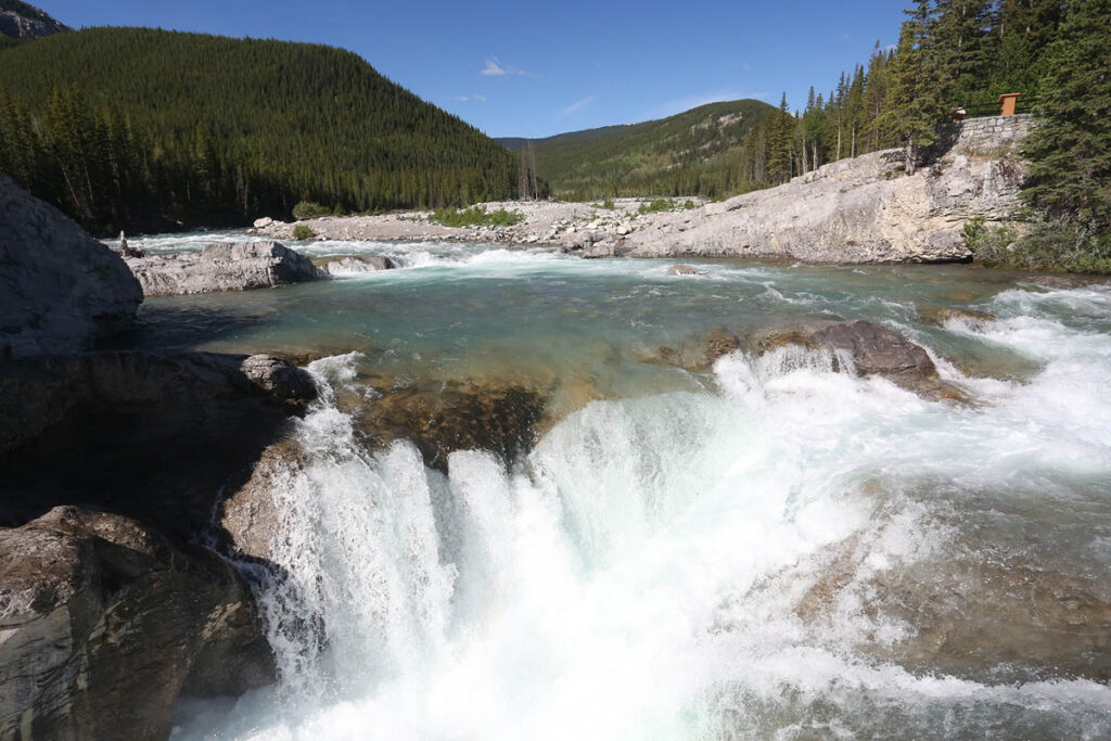
Elbow Falls.
Highway 546 through the Sheep River Valley
The Sheep River Valley lies immediately south of the Elbow River Valley, in an area of rolling foothills between open ranchlands to the east and the high peaks bordering ELBOW-SHEEP WILDLAND PROVINCIAL PARK to the west. Access is from the town of Turner Valley (take Sunset Boulevard west from downtown), along Highway 546. The Kananaskis Country boundary lies 25 km west of Turner Valley through rolling ranching land, from which point the highway follows the Sheep River for another 21 km to its confluence with BLUEROCK CREEK. A short distance west of the entrance to Kananaskis Country is Sandy McNabb Campground and various interpretive trails. Continuing along Highway 546, the road enters the SHEEP RIVER PROVINCIAL PARK. Originally set aside in 1973 as Sheep River Wildlife Sanctuary, the park protects the winter range of bighorn sheep. The sheep spend the summer farther up the valley, and for hundreds of years, they have migrated down to the open slopes alongside the Sheep River each fall. Sheep are the most common large mammal in the valley; explorer David Thompson reported that the Stoney also named the valley for its sheep (“itou-kai-you” in their language). At the Bighorn day-use area, a short trail leads to a viewpoint of open meadows that are critical winter habitats for approximately 200 sheep. SHEEP RIVER FALLS, a short distance before the end of the road, is reached by a short walk.
Highwood/Cataract Creek
The Highwood/Cataract Creek areas stretch from Peter Lougheed Provincial Park to the southern border of Kananaskis Country. This is the least-developed area in Kananaskis Country. The jagged peaks of the Highwood Mountains are its most dominant feature; high alpine meadows among the peaks are home to bighorn sheep, elk, and grizzlies. Lower down, spruce and lodgepole pine forests spread over most of the valley, giving way to grazing lands along the eastern flanks. Higher elevations, including along the Continental Divide, are protected by DON GETTY WILDLAND PROVINCIAL PARK. The main access from the north is along Highway 40, which drops 600 vertical metres in the 35 km between Highwood Pass and Highwood Junction. From the east, Highway 541 west of Longview joins Highway 40 at Highwood Junction. A lesser-used access is Highway 532, which branches west from Highway 22 about 37 km south of Longview. This unpaved road passes Indian Graves Campground, then begins a steep climb to PLATEAU MOUNTAIN, high above the tree line and with stunning views back across to Porcupine Hills.
The Forestry Trunk Road (Highway 940) leads south from Highwood Junction to the Crowsnest Pass area. The highlight along this unpaved and remote route is LIVINGSTONE FALLS. The main summer activities in this area of Kananaskis Country are hiking, horseback riding, climbing, and fishing. Winter use is primarily by snowmobilers.
Highway 532 over Plateau Mountain.