Banff National Park Hiking
After experiencing the international thrills of Banff Avenue, most people will want to see the real Banff National Park by hiking, which is, after all, the reason that millions of visitors flock here, thousands take low-paying jobs just to stay here, and others become so severely addicted that they start families and live happily ever after here.
Although many landmarks can be seen from the roadside, to really experience the park’s personality you’ll need to go for a hike. One of the best things about Banff’s 80-odd hiking trails is the variety. From short interpretive walks originating in town to easy hikes rewarded by spectacular vistas to myriad overnight backcountry opportunities, Banff’s trails offer something for everyone.
Before attempting any hikes, visit the Banff Visitor Centre (224 Banff Ave., 403/762-1550), where staff can advise you on the condition of trails and closures. The best book on hiking in the park is the Canadian Rockies Trail Guide, by Brian Patton and Bart Robinson, which covers each trail in exacting detail. Also recommended are waterproof GEM TREK MAPS, designed especially for hikers by a Banff-based company. We also have a page for Banff National Park Maps, which includes the relevant Gem Trek Maps for hiking in the park.
Hikes Near the Town of Banff
Fenland Trail
Length: 2 kilometres/1.2 miles (30 minutes) round-trip
Elevation gain: none
Rating: easy
Trailhead: Forty Mile Creek Picnic Area, Mount Norquay Road, 300 metres (0.2 mile) north of the rail crossing
If you’ve just arrived in town, this short interpretive trail provides an excellent introduction to the Bow Valley ecosystem. A brochure, available at the trailhead, explains the various stages in the transition between wetland and floodplain spruce forest, visible as you progress around the loop. This fen environment is prime habitat for many species of birds. The work of beavers can be seen along the trail, and elk are here during winter. This trail is also a popular shortcut for joggers and cyclists heading for Vermilion Lakes.
Tunnel Mountain Trail
Length: 2.3 kilometres/1.4 miles (30 to 60 minutes) one-way
Elevation gain: 300 metres/990 feet
Rating: easy/moderate
Trailhead: St. Julien Road, 350 metres (0.2 mile) south of Wolf Street
Accessible from town, this short hike is an easy climb to one of the park’s lower peaks. It ascends the western flank of Tunnel Mountain through a forest of lodgepole pine, switchbacking past some viewpoints before reaching a ridge just below the summit. Here the trail turns northward, climbing through a forest of Douglas fir to the summit (which is partially treed, preventing 360-degree views).
Bow River/Hoodoos Trail
Length: 4.8 kilometres/3 miles (60 to 90 minutes) one-way
Elevation gain: minimal
Rating: easy
Trailhead: Surprise Corner Viewpoint, Tunnel Mountain Drive
From a viewpoint famous for the Fairmont Banff Springs outlook, the trail descends to the Bow River, passing under the sheer east face of Tunnel Mountain. It then follows the river a short distance before climbing into a meadow where deer and elk often graze. From this perspective the north face of Mount Rundle is particularly imposing. As the trail climbs you’ll hear the traffic on Tunnel Mountain Road long before you see it. The trail ends at hoodoos, strange limestone-and-gravel columns jutting mysteriously out of the forest. An alternative to returning the same way is to catch the ROAM bus from Tunnel Mountain Campgrounds.
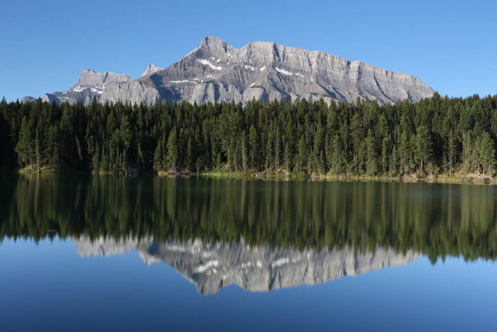
Mount Rundle from Johnson Lake Trail.
Sundance Canyon Trail
Length: 4.4 kilometres/2.7 miles (90 minutes) one-way
Elevation gain: 100 metres/330 feet
Rating: easy
Trailhead: Cave and Basin National Historic Site
Sundance Canyon is a rewarding destination across the river from downtown. Unfortunately, the first three kilometres (1.9 miles) are along a paved road that is closed to traffic (but not bikes) and hard on your soles. Occasional glimpses of the Sawback Range are afforded by breaks in the forest. Where the paved road ends, the 2.4-kilometre (1.5-mile) Sundance Loop begins. Sundance Creek was once a larger river whose upper drainage basin was diverted by glacial action. Its powerful waters have eroded into the soft bedrock, forming a spectacular overhanging canyon whose bed is strewn with large boulders that have tumbled in.
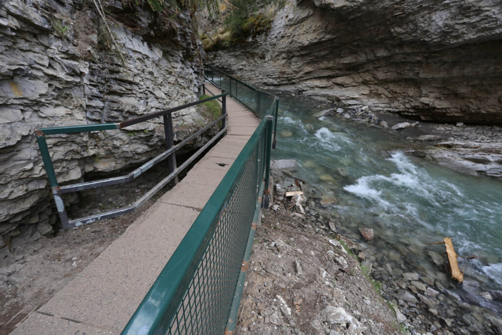
Johnston Canyon.
Spray River Loop Trail
Length: 6 kilometres/3.7 miles (2 hours) one-way
Elevation gain: 70 metres/230 feet
Rating: easy/moderate
Trailhead: From the Bow Falls parking lot, cross the Spray River and walk along Golf Course Road to behind the green of the first golf hole on the right-hand side of the road.
This trail follows one of the many fire roads in the park. It is not particularly interesting, but it’s accessible from downtown Banff and makes a pleasant way to escape the crowds. From behind the green of the 15th hole on the Stanley Thompson 18, the trail heads uphill into the forest. It follows the Spray River closely—when not in sight, the river can always be heard. For those so inclined, a river crossing one kilometre (0.6 mile) from the golf course allows for a shorter loop. Continuing south, the trail climbs a bluff for a good view of the Fairmont Banff Springs and Bow Valley. The return journey is straightforward with occasional views, ending at a locked gate behind the Fairmont Banff Springs, a short walk to Bow Falls.
For serious hikers this trail provides access to the park’s rugged and remote southern reaches, but there’s another interesting option involving this trail for eager day hikers. It involves arranging a lift to the trailhead of the Goat Creek hike in Spray Valley Provincial Park in Kananaskis Country. From this trailhead, it’s 19 kilometres/11.8 miles (six hours) one-way back to Banff down the Spray River watershed on a trail that drops 370 metres (1,210 feet) in elevation. The trail is most popular with mountain bikers and cross-country skiers.
Western Slope of Mount Rundle Trail
Length: 5.4 kilometres/3.3 miles (2 hours) one-way
Elevation gain: 480 metres/1,755 feet
Rating: moderate
Trailhead: From the Bow Falls parking lot, cross the Spray River and walk along Golf Course Road to behind the green of the first golf hole on the right-hand side of the road.
At 2,950 metres (9,680 feet), Mount Rundle is one of the park’s dominant peaks. Climbing to its summit is possible without ropes, but previous scrambling experience is advised. An alternative is to ascend the mountain’s western slope along an easy-to-follow trail that ends just over 1,000 vertical metres (3,280 vertical feet) before the summit. The trail follows the Spray River Trail from Golf Course Road, branching off left after 700 metres (0.4 mile). Climbing steadily, it breaks out of the enclosed forest after 2.5 kilometres (1.6 miles). The trail ends in a gully from which the undefined route to the summit begins.
Stoney Squaw Trail
Length: 2.4-kilometre/1.5-mile loop (1 hour round-trip)
Elevation gain: 180 metres/590 feet
Rating: easy
Trailhead: top of Mount Norquay Road, 6 kilometres (3.7 miles) from town
Looking north along Banff Avenue, Stoney Squaw’s 1,884-metre (6,180-foot) summit is dwarfed by Cascade Mountain, directly behind it. To get to the trailhead of a trail that leads to its easily reached summit, follow Mount Norquay Road to a parking lot in front of the resort’s day lodge. Immediately to the right of the entrance, a small sign marks the trail. The narrow, slightly overgrown trail passes through a thick forest of lodgepole pine and spruce before breaking out into the open near the summit. The sweeping panorama includes Vermilion Lakes, the Bow Valley, Banff, Spray River Valley, Mount Rundle, Lake Minnewanka, and the imposing face of Cascade Mountain (2,998 metres/9,840 feet). The return trail follows the northwest slope of Stoney Squaw to an old ski run at the opposite end of the parking lot.
Cascade Amphitheatre Trail
Length: 6.6 kilometres/4.1 miles (2 to 3 hours) one-way
Elevation gain: 610 metres/2,000 feet
Rating: moderate/difficult
Trailhead: day lodge, top of Mount Norquay Road, 6 kilometres (3.7 miles) from town
This enormous cirque and the subalpine meadows directly behind Cascade Mountain are one of the most rewarding destinations for hiking in the Banff area. The demanding trail begins by passing the day lodge, then skirting the base of several lifts, and following an old road to the floor of Forty Mile Valley. Keep right at all trail junctions. One kilometre (0.6 mile) after crossing Forty Mile Creek, the trail begins switchbacking up the western flank of Cascade Mountain through a forest of lodgepole pine. Along the way are breathtaking views of Mount Louis’s sheer east face. After the trail levels off, it enters a magnificent U-shaped valley, and the amphitheater begins to define itself. The trail becomes indistinct in the subalpine meadow, which is carpeted in colourful wildflowers during summer. Farther up the valley, vegetation thins out as boulder-strewn talus slopes cover the ground. If you sit still long enough on these rocks, marmots and pikas will slowly appear, emitting shrill whistles before disappearing again.
The most popular route to the summit of 2,998-metre (9,840-foot) Cascade Mountain is along the southern ridge of the amphitheater wall. It is a long scramble up scree slopes and is made more difficult by a false summit; it should be attempted only by experienced scramblers.
C Level Cirque Trail
Length: 4 kilometres/2.5 miles (90 minutes) one-way
Elevation gain: 455 metres/1,500 feet
Rating: moderate
Trailhead: Upper Bankhead Picnic Area, Lake Minnewanka Road, 3.5 kilometres (2.2 miles) beyond the TransCanada Highway underpass
From a picnic area that sits on the site of an abandoned mining town, the trail climbs steadily through a forest of lodgepole pine, aspen, and spruce to a pile of tailings and broken-down concrete walls. Soon after is a panoramic view of Lake Minnewanka, then the trail reenters the forest before ending in a small cirque with views down the Bow Valley to Canmore and beyond. The cirque is carved into the eastern face of Cascade Mountain, where snow often lingers until July. When the snow melts, the lush soil is covered in a carpet of colourful wildflowers.
Aylmer Lookout Trail
Length: 12 kilometres/7.5 miles (4 hours) one-way
Elevation gain: 810 metres/2,660 feet
Rating: moderate/difficult
Trailhead: Lake Minnewanka, Lake Minnewanka Road, 5.5 kilometres (3.4 miles) beyond the TransCanada Highway underpass
The first eight-kilometre (five-mile) stretch of this trail follows the northern shore of Lake Minnewanka from the day-use area to a junction. The right fork leads to a campground, while the left climbs steeply to the site of an old fire tower on top of an exposed ridge. The deep blue waters of Lake Minnewanka are visible, backed by the imposing peaks of Mount Girouard (2,995 metres/9,830 feet) and Mount Inglismaldie (2,964 metres/9,725 feet). Bighorn sheep often graze in this area. From here a trail forks left and continues climbing to the alpine tundra of Aylmer Pass. (Access along this trail is often restricted in summer due to bear activity—check at the visitors centre before heading out.)
Hikes Between Banff and Lake Louise
Cory Pass Trail
Length: 5.8 kilometres/3.6 miles (2.5 hours) one-way
Elevation gain: 920 metres/3,020 feet
Rating: moderate/difficult
Trailhead: Fireside Picnic Area, Banff end of the Bow Valley Parkway
This strenuous hike has a rewarding objective—a magnificent view of dog-toothed Mount Louis. The towering slab of limestone rises more than 500 metres (1,640 feet) from the valley below. Just over one kilometre (0.6 mile) from the trailhead, the trail divides. The left fork climbs steeply across an open slope to an uneven ridge that it follows before ascending yet another steep slope to Cory Pass—a wild, windy, desolate area surrounded in jagged peaks dominated by Mount Louis. An alternative to returning along the same trail is continuing down into Gargoyle Valley, following the base of Mount Edith before ascending to Edith Pass and returning to the junction one kilometre (0.6 mile) from the picnic area. Total distance for this trip is 13 kilometres (eight miles), a long day considering the steep climbs and descents involved.
Hiking at Sunshine Meadows
Sunshine Meadows, straddling the Continental Divide, is a unique and beautiful region of the Canadian Rockies. It’s best known as home to Sunshine Village, a self-contained alpine resort accessible only by gondola from the valley floor. But for a few short months each summer, the area is clear of snow and becomes a wonderland for hiking. Large amounts of precipitation create a lush cover of vegetation—over 300 species of wildflowers alone have been recorded here.
From Sunshine Village, trails radiate across the alpine meadow, which is covered in a colourful carpet of fireweed, glacier lilies, mountain avens, white mountain heather, and forget-me-nots (the meadows are in full bloom late July to mid-August). The most popular destination is ROCK ISLE LAKE, an easy 2.5-kilometre (1.6-mile) jaunt from the upper village that crosses the Continental Divide while only gaining 100 metres (330 feet) of elevation. Mount Assiniboine (3,618 metres/11,870 feet), known as the “Matterhorn of the Rockies,” is easily distinguished to the southeast. Various viewpoints punctuate the descent to an observation point overlooking the lake. From here, options include a loop around LARIX LAKE and a traverse along STANDISH RIDGE. If the weather is cooperating, it won’t matter which direction you head (so long as it’s along a formed trail); you’ll experience the Canadian Rockies in all their glory.
It’s possible to walk the 6-kilometre (3.7-mile) restricted-access road up to the meadows, but a more practical alternative is to take the BANFF SUNSHINE SUMMER GONDOLA (8am-6pm daily July-mid-Sept.). To get to the base of the gondola from Banff, follow the Trans-Canada Highway 9 kilometres (5.6 miles) west to Sunshine Village Road, which continues a similar distance along Healy Creek to the Sunshine Village parking lot.
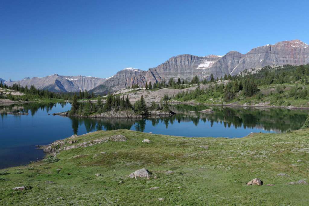
Rock Isle Lake, Sunshine Meadows.
Bourgeau Lake Trail
Length: 7.6 kilometres/4.7 miles (2.5 hours) one-way
Elevation gain: 730 metres/2,400 feet
Rating: moderate
Trailhead: signposted parking lot, TransCanada Highway, 3 kilometres (1.9 miles) west of Sunshine Village Junction
This trail follows Wolverine Creek to a small subalpine lake nestled at the base of an impressive limestone amphitheater. Although the trail is moderately steep, plenty of distractions along the way are worthy of a stop (and rest). Back across the Bow Valley, the Sawback Range is easy to distinguish. As the forest of lodgepole pine turns to spruce, the trail passes under the cliffs of Mount Bourgeau and crosses Wolverine Creek (below a spot where it tumbles photogenically over exposed bedrock). After strenuous switchbacks, the trail climbs into the cirque containing Bourgeau Lake. As you explore the lake’s rocky shore, you’ll hear the colonies of noisy pikas, even if you don’t see them.
Shadow Lake Trail
Length: 14.3 kilometres/8.9 miles (4.5 hours) one-way
Elevation gain: 440 metres/1,445 feet
Rating: moderate
Trailhead: Redearth Creek Parking Area, TransCanada Highway, 11 kilometres (6.8 miles) west of Sunshine Village Junction
Shadow is one of the many impressive subalpine lakes along the Continental Divide and a popular base for a great variety of day trips. It follows the old Redearth fire road for 11 kilometres (6.8 miles) before forking right and climbing into the forest. The campground is two kilometres (1.2 miles) beyond this junction, and just 500 metres (0.3 mile) farther is Shadow Lake Lodge. The lake is nearly two kilometres (1.2 miles) long, and from its southern shore trails lead to Ball Pass, Gibbon Pass, and Haiduk Lake.
Castle Lookout Trail
Length: 3.7 kilometres/2.3 miles (90 minutes) one-way
Elevation gain: 520 metres/1,700 feet
Rating: moderate
Trailhead: Bow Valley Parkway, 5 kilometres (3.1 miles) northwest of Castle Junction
However you travel through the Bow Valley, you can’t help but be impressed by Castle Mountain rising proudly from the forest floor. This trail takes you above the tree line on the mountain’s west face to the site of Mount Eisenhower fire lookout, abandoned in the 1970s and burned in the 1980s. From the Bow Valley Parkway, the trail follows a wide pathway for 1.5 kilometres (0.9 mile) to an abandoned cabin in a forest of lodgepole pine and spruce. It then becomes narrower and steeper, switchbacking through a meadow before climbing through a narrow band of rock and leveling off near the lookout site. Magnificent panoramas of the Bow Valley spread out before you in both directions. Storm Mountain can be seen directly across the valley.
Rockbound Lake Trail
Length: 8.4 kilometres/5.2 miles (2.5 hours) one-way
Elevation gain: 760 metres/2,500 feet
Rating: moderate/difficult
Trailhead: Castle Junction, Bow Valley Parkway, 30 kilometres (18.6 miles) west of Banff
This strenuous hike leads to a delightful body of water tucked behind Castle Mountain. For the first five kilometres (3.1 miles) the trail follows an old fire road along the southern flanks of Castle Mountain. Early in the season or after heavy rain, this section can be boggy. Glimpses of surrounding peaks ease the pain of the steady climb as the trail narrows. After eight kilometres (five miles) you’ll come to Tower Lake, which the trail skirts to the right before climbing a steep slope. From the top of the ridge, Rockbound Lake comes into view, and the reason for its name immediately becomes apparent. A scramble up any of the nearby slopes will reward you with good views.
Lake Louise Hiking
Lake Louise is one of the premier hiking areas in the Canadian Rockies, and to reflect its importance, we’ve created a section devoted to the very best hikes in this area. For details, visit the Lake Louise Hiking page.
Hikes along the Icefields Parkway
The Icefields Parkway, north of Lake Louise, has its own section on this website. Please visit Icefields Parkway Hiking and Columbia Icefield Hiking.