Waterton Lakes National Park Scenic Drives
Hiking is definitely the reason most visitors are drawn to Waterton Lakes National Park, but there are also a number of scenic drives. Before heading out, stop in the village at the WATERTON LAKES VISITOR CENTRE (404 Cameron Falls Dr., 403/859-5133, 8:30 a.m. to 4:30 p.m. daily) to learn about the natural and human history you’ll encounter firsthand as you tour through Waterton Lakes National Park.
Akamina Parkway
Reopened in 2021 after major rehabilitation work following the 2017 wildfire, this road, snow-free from May to October, starts in the town site and switchbacks up into the CAMERON CREEK VALLEY, making an elevation gain of 400 metres (1,310 feet) before ending after 16 kilometres (10 miles) at Cameron Lake. The viewpoint one kilometre (0.6 mile) from the junction of the park road is on a tight curve, so park off the road. From this lookout, views extend over the town site and the Bear’s Hump, which was originally part of a high ridge that extended across the lake to Vimy Peak (glacial action ultimately wore down the rest of the ridge). This section of the road is also a good place to view bighorn sheep. Between here and Cameron Lake there are several picnic areas and stops of interest, including the site of Alberta’s first producing oil well and, a little farther along the road, the site of OIL CITY, the town that never was.
CAMERON LAKE, at the end of the road, is a 2.5-kilometre-long (1.5-mile-long) subalpine lake that reaches depths of more than 40 metres (130 feet). It lies in a large cirque carved out about 11,000 years ago by a receding glacier. Mount Custer, at the southern end of the lake, is in Montana. Waterton has no glaciers, but Herbst Glacier on Mount Custer can be seen from here. To the west (right) of Custer is Forum Peak (2,225 metres/7,300 feet), whose summit cairn marks the boundaries of Alberta, Montana, and British Columbia.
Beside the lakeshore are enclosed information boards and CAMERON LAKE BOAT RENTALS (403/627-6443, 9 a.m. to 5 p.m. daily June to Sept., until 6:30 pm in July and Aug.) which rents kayaks, canoes, paddleboards, rowboats, and pedal boats at reasonable prices. A trail leads along the lake’s west shoreline, ending after 1.5 kilometres (0.9 mile) at a viewing platform surrounded by cow parsnip; allow 30 minutes each way. Take notice of bear warnings for this trail, as it ends in prime grizzly habitat.
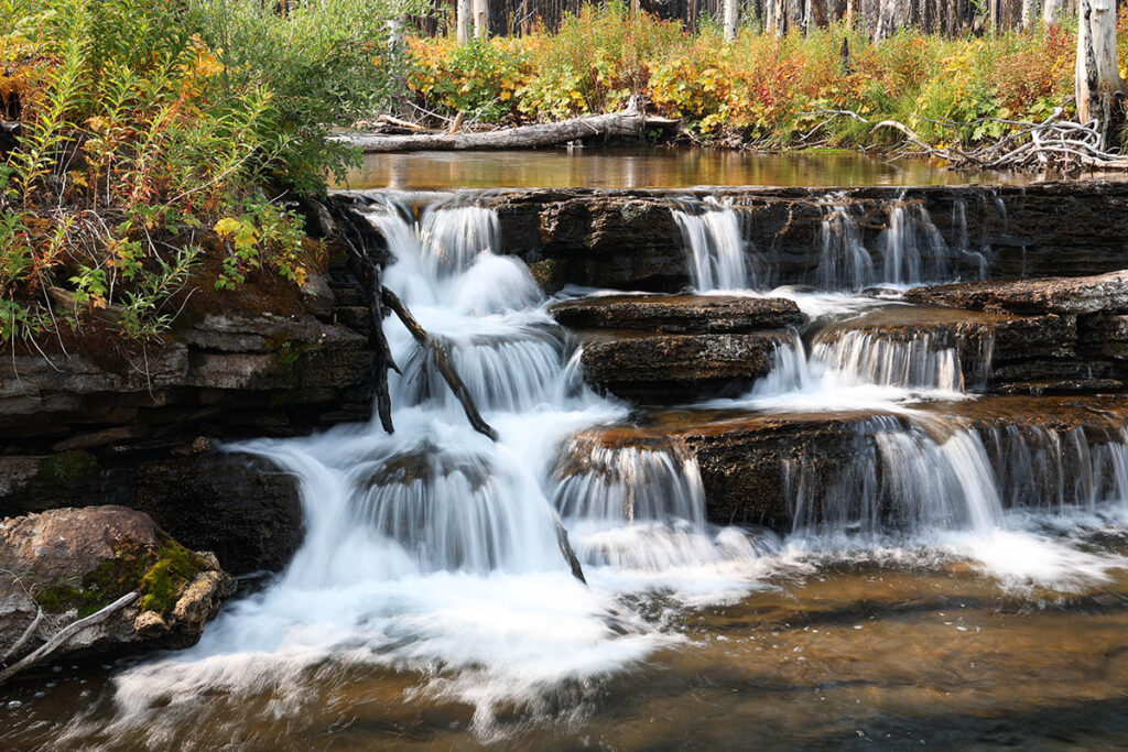
Cascades along Akamina Parkway.
Red Rock Canyon Parkway
The best roadside wildlife viewing within Waterton Lakes National Park is along this 13-kilometre (eight-mile) road that starts near the golf course and finishes at RED ROCK CANYON. It is generally open May through October, depending on snow cover. The transition between rolling prairies and mountains takes place abruptly as you travel up the Blakiston Valley. Black bears (and very occasionally grizzly bears) can be seen feeding on saskatoon berries along the open slopes to the north. Mount Blakiston (2,920 metres/9,580 feet), Waterton Lakes National Park’s highest summit, is visible from a viewpoint three kilometres (1.9 miles) along the road. The road passes interpretive signs, picnic areas, and Crandell Mountain Campground. At the end of the road is Red Rock Canyon, a water-carved gorge where the bedrock, known as argillite, contains a high concentration of iron. The iron oxidizes and turns red when exposed to air—literally going rusty. A short interpretive trail leads along the canyon.
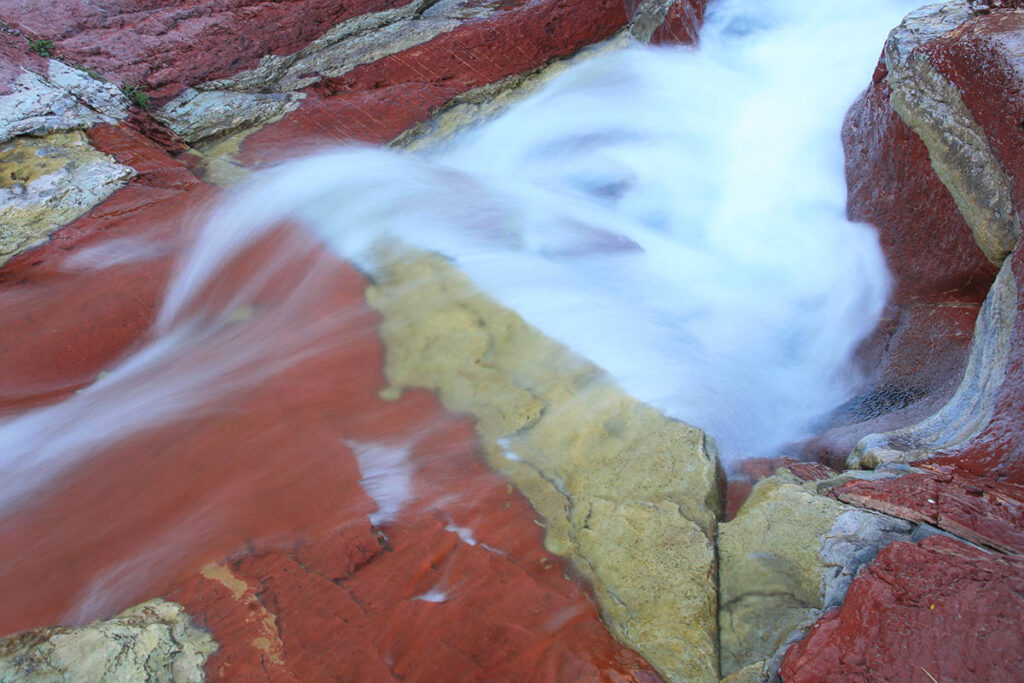
Red Rock Canyon.
Chief Mountain International Highway
This 25-kilometre (15.5-mile) highway, part of Highway 6, borders the eastern boundaries of Waterton Lakes National Park and joins it to Glacier National Park in Montana. It starts east of the park gate at MASKINONGE LAKE and climbs for seven kilometres (4.3 miles) to a viewpoint where many jagged peaks and the entrance to Waterton Valley can be seen. The road then rounds Sofa Mountain, which still bears the scars from a wildfire that swept up its lower slopes in 1998. To the south, the distinctive peak is CHIEF MOUNTAIN, which has been separated from the main mountain range by erosion. The road then passes the Belly River Campground and climbs to the border crossing of Chief Mountain. Hours of operation at this port of entry are 9 a.m. to 6 p.m. daily from mid-May to the end of May and early September to the end of September, 7 a.m. to 10 p.m. daily from June to early September. When the post is closed, you must use the Carway/Piegan port of entry (7 a.m. to 11 p.m. daily year-round). It’s on Alberta Highway 2 south of Cardston (or on Montana Highway 89 north of St. Mary, depending on your direction of travel).
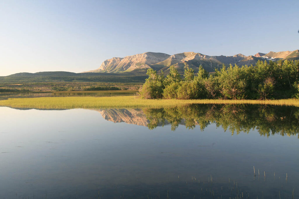
Maskinonge Lake.
From the border, it’s 50 kilometres (31 miles) to St. Mary and the spectacular GOING-TO-THE-SUN HIGHWAY through GLACIER NATIONAL PARK. Stop by the park’s St. Mary Visitor Center (406/888-7800). A good source of pre-trip information is the official Glacier National Park website.
If you are crossing the border into Canada from the south, your initial impression of the park will be misleading, as this section lacks the high peaks and impressive lakes farther west, near the town site.