Radium Hot Springs
The small service center of Radium Hot Springs (pop. 900) sits along Highway 93/95 at the southwest entrance to Kootenay National Park. Its setting is spectacular; most of the town lies on benchlands above the Columbia River, from which the panoramic views take in the Canadian Rockies to the east and the Purcell Mountains to the west. As well as providing accommodations and other services for park visitors and highway travellers, Radium is a destination in itself for many travellers. The town is just three kilometres (two miles) from the hot springs for which it is named and boasts a wildlife-rich wetland on its back doorstep, two excellent golf courses, and many other recreational opportunities.
Radium sits in the Rocky Mountain Trench, which has been carved over millions of years by the Columbia River. From its headwaters south of Radium, the Columbia flows northward through a 180-kilometre-long (110-mile-long) wetland to Golden, continuing north for a similar distance before reversing course and flowing south into the United States. The wetland nearby Radium holds international significance, not only for its size (26,000 hectares/64,250 acres), but also for the sheer concentration of wildlife it supports. More than 100 species of birds live among the sedges, grasses, dogwoods, and black cottonwoods surrounding the convoluted banks of the Columbia. Of special interest are blue herons in large numbers and ospreys in one of the world’s highest concentrations.

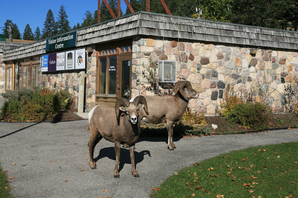
Bighorn sheep are common at Radium Hot Springs.
Radium Hot Springs Pools
This soothing Radium Hot Springs (250/347-9485, 9 a.m. to 11 p.m. daily in summer, noon to 9 p.m. daily the rest of the year) lies inside the park but just three kilometres (1.9 miles) northeast of the town of the same name, which is outside the park boundary.
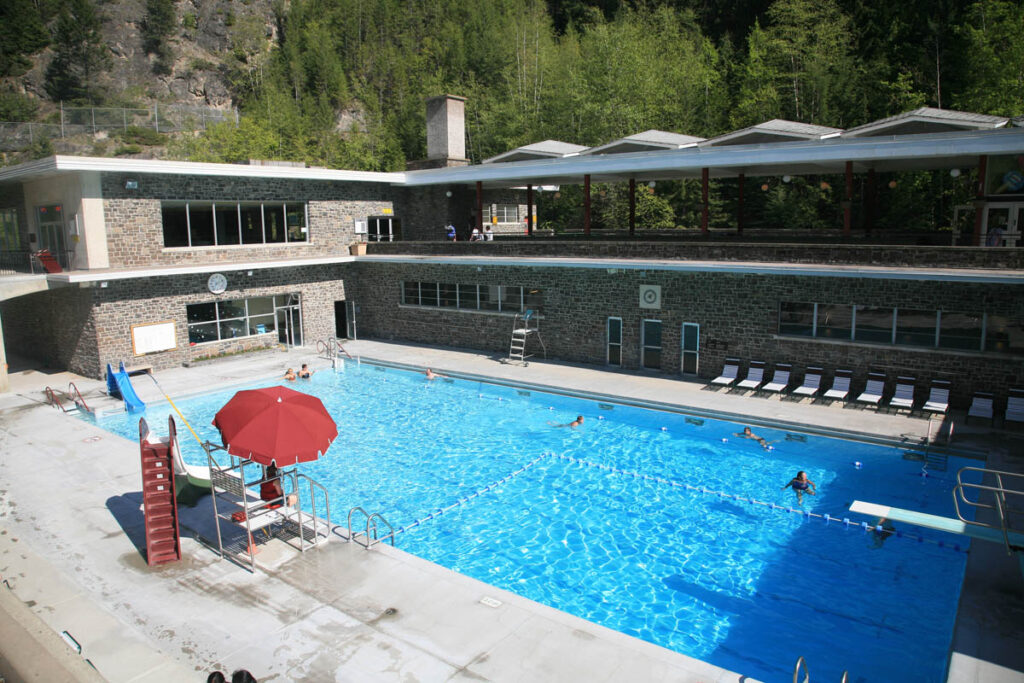
The piping hot water is diverted from its natural course into the commercial pools, including one that is Canada’s largest. Steep cliffs tower directly above the hot pool, whose waters are coloured a milky blue by dissolved salts, which include calcium bicarbonate and sulfates of calcium, magnesium, and sodium. The hot pool (39°C/97°F) is particularly stimulating in winter, when it’s edged by snow and covered in steam—your head is almost cold in the chill air, but your submerged body melts into oblivion. If you’re camping at Kootenay National Park’s Redstreak Campground, you can reach the complex on foot.

The hot springs are the main attraction at Radium.
Radium Hot Springs Festivals
The Columbia River Wetland also lies along the Pacific Flyway, so particularly large numbers of ducks, Canada geese, and other migratory birds gather here in spring and autumn. The northbound spring migration is celebrated with the WINGS OVER THE ROCKIES, which is held in the second week of May. The festival features ornithologist speakers, field trips on foot and by boat, workshops, and events tailored especially for children, all of which take place in Radium and throughout the Columbia Valley. At any time of year, use the festival website to source the valley’s best birding spots.
Radium Hot Springs Hotels

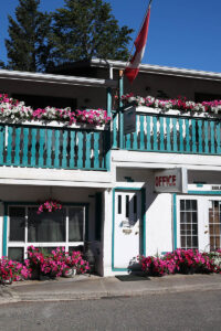
Motels in Radium pride themselves with flower displays.
Radium, with a population of just 900, has more than a dozen motels, an indication of its importance as a highway stop for overnight travellers. Those that lie along the access road to Kootenay National Park come alive with colour through summer as each tries to outdo the others with floral landscaping.
MISTY RIVER LODGE (5036 Hwy. 93, 250/347-9912), at the top end of the motel strip in Radium Hot Springs, provides an excellent base for travellers on a budget. Also known as Radium Hot Springs International Hostel, this converted motel has 11 beds in dormitories and private rooms that include a room that combines valley views with a full kitchen. Amenities include a communal kitchen, a lounge, and a big deck with even bigger views of the distant Purcell Mountains. Guests can also rent bikes and canoes.
ALPEN MOTEL (5022 Hwy. 93, 250/347-9823 or 888/788-3891), in the middle of the motel strip, has arguably the best and brightest flowers out front. The air-conditioned rooms are among the best along the strip, which is reflected in the price, which includes passes to the hot springs.
Radium Hot Springs Campgrounds
Within Kootenay National Park, but accessed from in town off Highways 93/95, is REDSTREAK CAMPGROUND (mid-May to mid-Oct.), which has 242 sites, showers, and kitchen shelters. A limited number of sites can be reserved through the Parks Canada Campground Reservation Service.
The closest commercial camping is at CANYON RV RESORT (5012 Sinclair Creek Rd., 250/347-9564, Apr. to Oct.), nestled in its own private valley immediately north of the Highway 93/95 junction. Treed sites are spread along both sides of a pleasant creek, and all facilities are provided, including a playground and laundry.
Perfectly described by its name, DRY GULCH PROVINCIAL PARK (250/422-3003, May to mid-Oct.) offers 26 sites four kilometres (2.5 miles) south of town. Typical of provincial park camping, each site has a picnic table and fire pit but no hookups. Make reservations through BC Parks.
Radium Hot Springs Information
The best source of information is KOOTENAY VISITOR CENTRE (7556 Main St. E, 250/347-9615, 9 a.m. to 7 p.m. daily in summer, 9 a.m. to 5 p.m. daily in spring and fall) in the east side of Hwy. 93/95, at the base of the access road to Redstreak Campground. Here you can collect free maps with short hiking trail descriptions, find out about local attractions, get the weather forecast, and browse through a small gift shop to buy maps/books.
For further information on the town, contact the local chamber of commerce: TOURISM RADIUM.

Kootenay Visitor Centre.
Radium Hot Springs Maps
The best map showing Radium and the surrounding area is the GEM TREK MAPS Kootenay National Park Map (1:100,000). Gem Trek is a Banff-based business that has been publishing high-quality Canadian Rockies maps for over 30 years.
Like all maps in the Gem Trek series, the waterproof and tear-resistant Kootenay National Park Map is created using computer-generated 3-D imagery to clearly define changes in elevation and GPS to plot hiking trails. The backs of the maps are filled with trail information as well as tidbits of history.
This Gem Trek Map is available directly from the company website:
It is also sold at the Kootenay Visitor Centre and outdoor retailers in the Columbia Valley.
Radium Hot Springs Webcams
For a Radium Hot Springs webcam, check out one of the BC Ministry of Transportation and Infrastructure webcams, which are refreshed every few minutes. One cool feature of these highway webcams is the option to “Replay the Day,” which shows a compilation of the previous day’s screenshots in a 15-second video. Click on this link:
