Banff National Park Scenic Drives
Banff National Park scenic drives mean you don’t need to travel deep into the backcountry to view the most spectacular features—many are visible from the roadside. The following section includes roads close to the town of Banff. We have devoted a different section of this website to one of the world’s most scenic highways, the Icefields Parkway.
Vermilion Lakes Drive
Accessed from this road close to the town of Banff, this series of shallow lakes forms an expansive montane wetland supporting a variety of mammals and 238 species of birds. Vermilion Lakes Drive, paralleling the TransCanada Highway immediately west of Banff, provides the easiest access to the area. The level of First Vermilion Lake was once controlled by a dam. Since its removal, the level of the lake has dropped. This is the beginning of a long process that will eventually see the area evolve into a floodplain forest such as is found along the Fenland Trail. The entire area is excellent for wildlife viewing, especially in winter when it provides habitat for elk, coyote, and the occasional wolf.
Mount Norquay Road
One of the best views of town accessible by vehicle is on this road, which switchbacks steeply to the base of Mount Norquay, the local hangout for skiers and boarders. On the way up are several lookouts, including one near the top where bighorn sheep often graze.
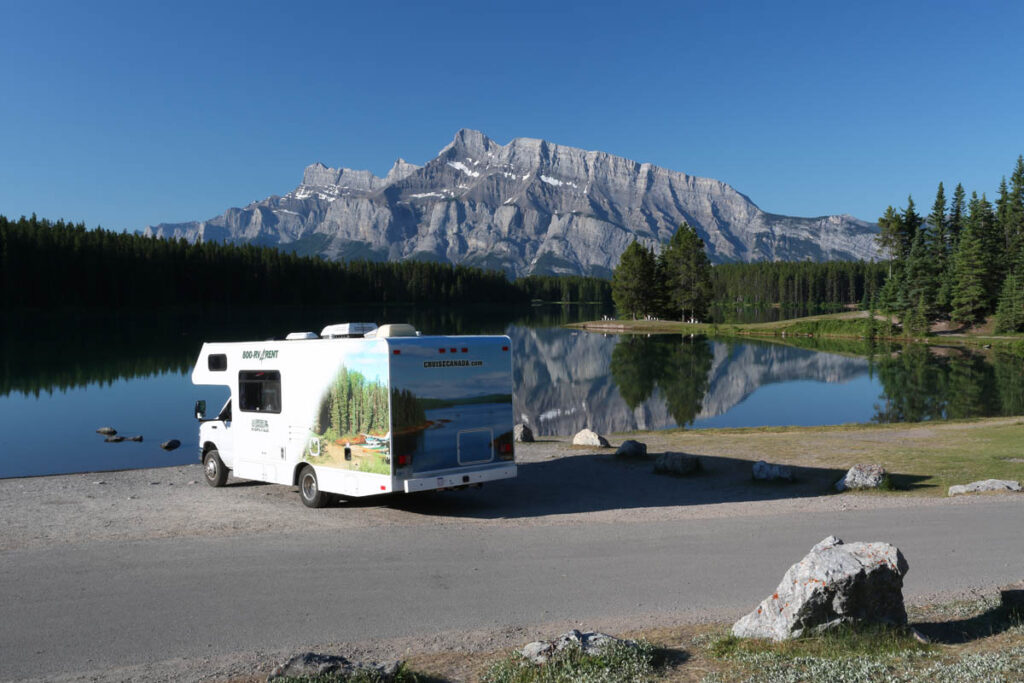
Lake Minnewanka Road
Lake Minnewanka Road begins where Banff Avenue ends at the northeast end of town. An alternative to driving along Banff Avenue is to take Buffalo Street, opposite the Banff Park Museum, and follow it around Tunnel Mountain, passing the campground and several viewpoints of the north face of Mount Rundle, rising vertically from the forested valley. This road eventually rejoins Banff Avenue at the Banff Rocky Mountain Resort.
After passing under the TransCanada Highway, CASCADE FALLS is obvious off to the left. The base of the falls can be easily reached in 10 minutes (climbing higher without the proper equipment is dangerous). In winter, these falls freeze, and you’ll often see ice climbers slowly making their way up the narrow thread of frozen water. Directly opposite is a turn to CASCADE PONDS, a day-use area that was devastated by flooding in 2013, but is still a popular spot where families gather on warmer days to sunbathe and barbecue.
The next turnout along this road is at LOWER BANKHEAD. During the early 1900s, Bankhead was a booming mining town producing 200,000 tons of coal a year. The poor quality of coal and bitter labor disputes led to the mine’s closure in 1922. Soon after, all the buildings were moved or demolished.
From the parking lot at Lower Bankhead, a 1.1-kilometre (0.7-mile) interpretive trail leads down through the industrial section of the town and past an old mine train. The town’s 1,000 residents lived on the other side of the road at what is now known as Upper Bankhead. Just before the Upper Bankhead turnoff, the foundation of the Holy Trinity Church can be seen on the side of the hill to the right. Not much remains of Upper Bankhead. It is now a day-use area with picnic tables, kitchen shelters, and firewood. Through the meadow to the west of here are some large slag heaps, concealed mine entrances, and various stone foundations.
Two Jack Lake, Lake Minnewanka Road
Lake Minnewanka
Minnewanka (Lake of the Water Spirit) is the largest body of water in Banff National Park. Mount Inglismaldie (2,964 metres/9,720 feet) and the Fairholme Range form an imposing backdrop. The reservoir was first constructed in 1912, and additional dams were built in 1922 and 1941 to supply hydroelectric power to Banff. Even if you don’t feel up to an energetic hike, it’s worth parking at the facility area and going for a short walk along the lakeshore. You’ll pass a concession selling snacks and drinks, then the tour boat dock, before entering an area of picnic tables and covered cooking shelters—the perfect place for a picnic. Children will love exploring the rocky shoreline and stony beaches in this area, but you should continue farther around the lake, if only to escape the crowds.
LAKE MINNEWANKA CRUISE is a 90-minute cruise to the far reaches of the lake, passing the Devil’s Gap formation. It departs from the dock late May to early October 3 to 5 times daily (first sailing is 10 a.m.). An easy walking trail leads past a number of picnic spots and rocky beaches to Stewart Canyon. The lake is decent for fishing (lake trout to 15 kilograms/33 pounds) and is the only one in the park where motorboats are allowed. The same company operating the tour boats rents aluminum boats with small outboard engines.
From Lake Minnewanka the road continues along the reservoir wall, passing a plaque commemorating the Palliser Expedition. You’ll often have to slow down along this stretch of road for bighorn sheep. The road then descends to TWO JACK LAKE and a small day-use area. Take the turnoff to JOHNSON LAKE, to access a lakeside trail, good swimming on the warmest days of summer, and picnic facilities with views across to Mount Rundle.
Bow Valley Parkway
Two roads link Banff to Lake Louise. The TransCanada Highway is the quicker route, more popular with through traffic. The other is the more scenic 51-kilometre (32-mile) Bow Valley Parkway, which branches off the TransCanada Highway five kilometres (3.1 miles) west of Banff. Cyclists will appreciate this road’s two long, divided sections and low speed limit (60 kph/37 mph). Along this route are several impressive viewpoints, interpretive displays, picnic areas, good hiking, great opportunities for viewing wildlife, a hostel, three lodges, and campgrounds. Between March and late June, the southern end of the parkway (as far north as Johnston Canyon) is closed 6 p.m. to 9 a.m. daily for the protection of wildlife.
As you enter the parkway, you pass the quiet, creekside Fireside picnic area, where an interpretive display describes how the Bow Valley was formed. At BACKSWAMP VIEWPOINT, you can look upstream to the site of a former dam, now a swampy wetland filled with aquatic vegetation. Farther along the road is another wetland at MULESHOE. This wetland consists of oxbow lakes that were formed when the Bow River changed its course and abandoned its meanders for a more direct path. Across the parkway is a one-kilometre (0.6-mile) trail that climbs to a viewpoint overlooking the valley. (The slope around this trail is infested with wood ticks during late spring/early summer, so be sure to check yourself carefully after hiking in this area.) To the east, Hole-in-the-Wall is visible. This large-mouthed cave was created by the Bow Glacier, which once filled the valley. As the glacier receded, its meltwater dissolved the soft limestone bedrock, creating what is known as a solution cave.
Beyond Muleshoe the road inexplicably divides for a few car lengths. A large white spruce stood on the island until it blew down in 1984. The story goes that while the road was being constructed, a surly foreman was asleep in the shade of the tree, and not daring to rouse him, workers cleared the roadway around him. The road then passes through particularly hilly terrain, part of a massive rock slide that occurred approximately 8,000 years ago.
Continuing down the parkway, you’ll pass the following sights.
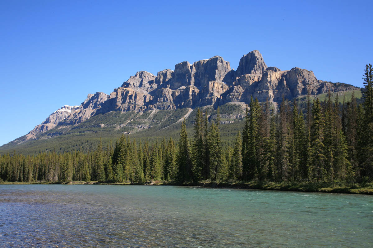
Castle Mountain, Bow Valley Parkway
Johnston Canyon
Johnston Creek drops over a series of spectacular waterfalls here, deep within the chasm it has carved into the limestone bedrock. The canyon is not nearly as deep as Maligne Canyon in Jasper National Park—30 metres (100 feet) at its deepest, compared to 50 metres (165 feet) at Maligne—but the catwalk that leads to the lower falls has been built through the depths of the canyon rather than along its lip, making it seem just as spectacular. The LOWER FALLS are one kilometre (0.6 mile) from the Bow Valley Parkway, while the equally spectacular UPPER FALLS are a further 1.6 kilometres (one mile) upstream. Beyond this point are the INK POTS, shallow pools of spring-fed water. While in the canyon, look for fast-moving black swifts zipping through the air.
Silver City
At the west end of Moose Meadows, a small plaque marks the site of Silver City. At its peak, this boomtown had a population of 2,000, making it bigger than Calgary at the time. The city was founded by John Healy, who also founded the notorious Fort Whoop-Up in Lethbridge. During its heady days, five mines were operating, extracting not silver but ore rich in copper and lead. The town had a half dozen hotels, four or five stores, two real-estate offices, and a station on the transcontinental rail line when its demise began. Two men, named Patton and Pettigrew, salted their mine with gold and silver ore to attract investors. After selling 2,000 shares at $5 each, they vanished, leaving investors with a useless mine. Investment in the town ceased, mines closed, and the people left. Only one man refused to leave. His name was James Smith, but he was known to everyone as Joe. In 1887, when Silver City came under the jurisdiction of the National Parks Service, Joe was allowed to remain. He did so and was friendly to everyone, including the Stoney, Father Albert Lacombe (who occasionally stopped by), well-known Banff guide Tom Wilson, and of course the animals who grazed around his cabin. By 1926, he was unable to trap or hunt due to failing eyesight, and many people tried to persuade him to leave. It wasn’t until 1937 that he finally moved to a Calgary retirement home, where he died soon after.
Castle Mountain to Lake Louise
After you leave the former site of Silver City, the aptly named CASTLE MOUNTAIN comes into view. It’s one of the park’s most recognizable peaks and most interesting geographical features. The mountain consists of very old rock (approximately 500 million years old) sitting atop much younger rock (a mere 200 million years old). This unusual situation occurred as the mountains were forced upward by pressure below the earth’s surface, thrusting the older rock up and over the younger rock in places.
The road skirts the base of the mountain, passes Castle Mountain Chalets (gas, food, and accommodations), and climbs a small hill to STORM MOUNTAIN VIEWPOINT, which provides more stunning views and a picnic area. Then it’s on to another viewpoint at MORANT’S CURVE, from where Temple Mountain is visible. After passing another picnic area the Bow Valley Parkway rejoins the TransCanada Highway at Lake Louise.